Tocht Stappen Gueberschwihr - La promenade du Grand Cru Goldert - Gueberschwihr - Photo

La promenade du Grand Cru Goldert - Gueberschwihr

 tracegps
tracegps

Gebruiker

© OpenStreetMap contributors
Lengte
Lengte
4,1 km
Max. hoogte
Max. hoogte
381 m
Positief hoogteverschil
134 m
Km-Effort
Km-Effort  
5,9 km
Min. hoogte
Min. hoogte
260 m
Negatief hoogteverschil
139 m
Boucle
Boucle
Ja
Datum van aanmaak :
2014-12-10 00:00:00.0
Laatste wijziging :
2014-12-10 00:00:00.0

(0 Bericht)

Stappen
Stappen
1h30
Moeilijkheid : Gemakkelijk

Scan deze QR-code om de tocht te openen in de SityTrail-applicatie

Gratisgps-wandelapplicatie

Logo SityTrail SityTrail

IGN / Geografische instituten

SityTrail uit de App Store downloaden SityTrail uit Google Play downloaden

Logo SityTrail SityTrail World

De wereld gaat voor u open

SityTrail uit de App Store downloaden SityTrail uit Google Play downloaden SityTrail op Huawei AppGallery downloaden

Over ons

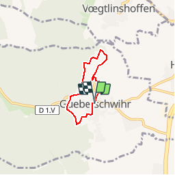
Tocht Stappen van 4,1 km beschikbaar op Grand Est, Haut-Rhin, Gueberschwihr. Deze tocht wordt voorgesteld door tracegps.

Beschrijving

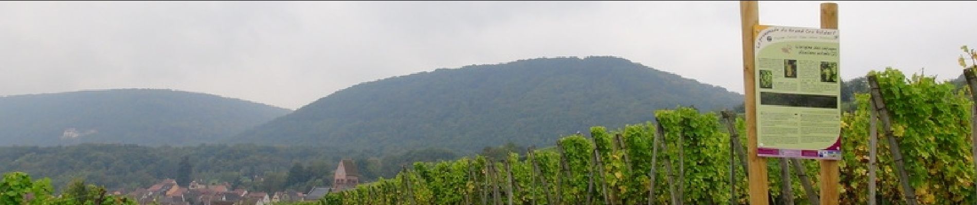
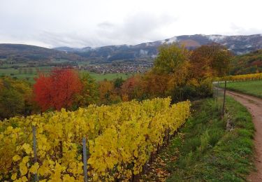
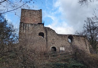
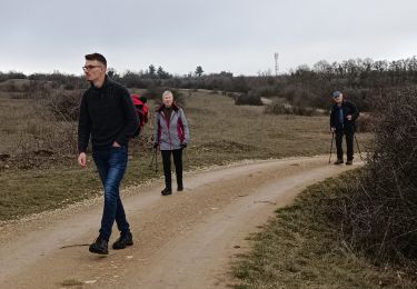
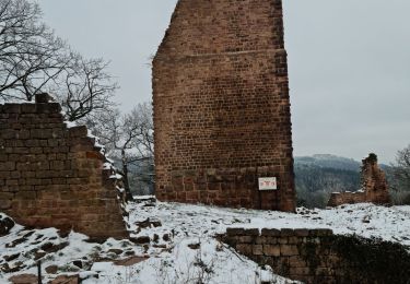
Gueberschwihr : Cité médiévale caractéristique de la Route des Vins, blottie à flanc de coteaux dans un écrin verdoyant, cette belle bourgade a gardé son charme d’antan, son authenticité et son riche patrimoine architectural. Dominant la place du village, le clocher roman du 12ème siècle, joyau du village, est une des étapes incontournables de la Route Romane d’Alsace. Son Grand Cru Goldert et son sentier viticole complètent harmonieusement ce décor idyllique. La promenade du Grand Cru Goldert présente un ensemble de panneaux d’information spécifique sur la biodiversité des collines du piémont viticole. Pour le promeneur, cette découverte implique d’abord un cheminement au travers de quelques ruelles caractéristiques de la richesse médiévale de Gueberschwihr. La promenade gagne ensuite progressivement le vignoble en longeant la lisière de la forêt. C’est à l’arrivée à la table d’orientation que le paysage s’ouvre pleinement et donne toute sa force contemplative. Le surplomb de la plaine est important et le regard est rapidement invité à se porter au loin, sur le Kaiserstuhl et la Forêt Noire en particulier. ® Départ : Place de la Mairie à Gueberschwihr.

Hoogteprofiel

Foto's

Plaatsbepaling

Land:
France
Regio :
Grand Est
Departement/Provincie :
Haut-Rhin
Gemeente :
Gueberschwihr
Locatie:
Unknown
Vertrek:(Dec)
Vertrek:(UTM)
371386 ; 5318211 (32U) N.

Wandeltochten in de omgeving

Tocht Stappen Westhalten - 2021 03 04 Westhalten - Photo
Stappen
E.BURCK

Stappen

Gemakkelijk
(1)
Westhalten, Grand Est, Haut-Rhin, France
7,7 km | 11,3 km-effort
2h 21min
Ja
Tocht Stappen Osenbach - Osenbach - Sentier des Sols - Photo
Stappen
gscheven

Stappen

Gemakkelijk
(1)
Osenbach, Grand Est, Haut-Rhin, France
4,7 km | 6,6 km-effort
3h 0min
Ja
Tocht Stappen Eguisheim - suuntoapp-Hiking-2023-12-29T09-05-16Z - Photo
Stappen
GUIDE
holtzv

Stappen

Medium
Eguisheim, Grand Est, Haut-Rhin, France
22 km | 32 km-effort
7h 16min
Ja
Tocht Stappen Rouffach - SityTrail - Rouffach vers Schauenberg variante - Photo
Stappen
E.BURCK

Stappen

Gemakkelijk
(1)
Rouffach, Grand Est, Haut-Rhin, France
10,6 km | 15,3 km-effort
3h 29min
Ja
Tocht Stappen Pfaffenheim - Schauenberg 1 - Photo
Stappen
regisbodilis

Stappen

Gemakkelijk
(1)
Pfaffenheim, Grand Est, Haut-Rhin, France
10,3 km | 16,5 km-effort
3h 30min
Ja
Tocht Stappen Westhalten - Westhalten - Rouffach  - Photo
Stappen
Richard68500

Stappen

Moeilijk
Westhalten, Grand Est, Haut-Rhin, France
8,9 km | 13 km-effort
3h 22min
Ja
Tocht Stappen Husseren-les-Châteaux - Husseren les Châteaux - Photo
Stappen
oscar1

Stappen

Gemakkelijk
Husseren-les-Châteaux, Grand Est, Haut-Rhin, France
12,7 km | 19,1 km-effort
3h 24min
Ja
Tocht Stappen Soultzmatt - Rando du 30/03/2034 - Photo
Stappen
boubou68

Stappen

Moeilijk
Soultzmatt, Grand Est, Haut-Rhin, France
19,5 km | 29 km-effort
4h 32min
Ja
Tocht Stappen Gueberschwihr - Les Marcheurs...et la fondue..26/01/2024 - Photo
Stappen
boubou68

Stappen

Medium
Gueberschwihr, Grand Est, Haut-Rhin, France
20 km | 31 km-effort
4h 59min
Ja


Sluiten
Mijn abonnementen