


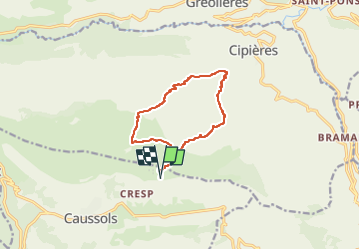
Caussols Aven de Renne à l'envers

verotrail
Gebruiker

Lengte
11,5 km

Max. hoogte
1269 m

Positief hoogteverschil
454 m
Km-Effort
17,6 km

Min. hoogte
857 m

Negatief hoogteverschil
454 m
Boucle
Ja
Datum van aanmaak :
2022-04-16 13:57:44.462
Laatste wijziging :
2022-04-16 13:59:04.719
3h59
Moeilijkheid : Medium

Gratisgps-wandelapplicatie
 SityTrail
IGN / Geografische instituten
SityTrail Plus
De wereld gaat voor u open
Over ons
Tocht Te voet van 11,5 km beschikbaar op Provence-Alpes-Côte d'Azur, Alpes-Maritimes, Caussols. Deze tocht wordt voorgesteld door verotrail.
Plaatsbepaling
Land:
France
Regio :
Provence-Alpes-Côte d'Azur
Departement/Provincie :
Alpes-Maritimes
Gemeente :
Caussols
Locatie:
Unknown
Vertrek:(Dec)
Vertrek:(UTM)
332890 ; 4846347 (32T) N.
Opmerkingen