


2022-04-30

Lucquiaud
Gebruiker

Lengte
216 km

Max. hoogte
268 m

Positief hoogteverschil
2869 m
Km-Effort
255 km

Min. hoogte
53 m

Negatief hoogteverschil
2859 m
Boucle
Neen
Datum van aanmaak :
2022-04-28 15:53:23.748
Laatste wijziging :
2022-04-30 19:05:22.717
48h33
Moeilijkheid : Zeer moeilijk

Gratisgps-wandelapplicatie
 SityTrail
IGN / Geografische instituten
SityTrail Plus
De wereld gaat voor u open
Over ons
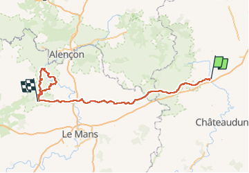
Tocht Mountainbike van 216 km beschikbaar op Centre-Val de Loire, Eure-et-Loir, Illiers-Combray. Deze tocht wordt voorgesteld door Lucquiaud.
Plaatsbepaling
Land:
France
Regio :
Centre-Val de Loire
Departement/Provincie :
Eure-et-Loir
Gemeente :
Illiers-Combray
Locatie:
Unknown
Vertrek:(Dec)
Vertrek:(UTM)
369828 ; 5351555 (31U) N.
Opmerkingen