


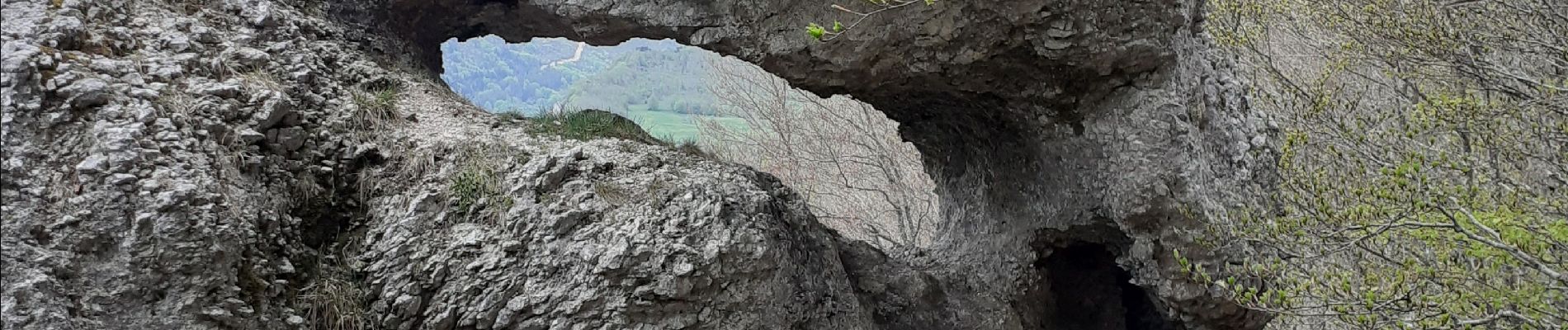
Double arche de Rucla

cousam
Gebruiker


Lengte
3,2 km

Max. hoogte
1404 m

Positief hoogteverschil
185 m
Km-Effort
5,7 km

Min. hoogte
1209 m

Negatief hoogteverschil
187 m
Boucle
Ja
Datum van aanmaak :
2022-05-09 13:13:04.832
Laatste wijziging :
2022-05-09 16:16:38.928
1h05
Moeilijkheid : Gemakkelijk

Gratisgps-wandelapplicatie
 SityTrail
IGN / Geografische instituten
SityTrail Plus
De wereld gaat voor u open
Over ons
Tocht Stappen van 3,2 km beschikbaar op Auvergne-Rhône-Alpes, Drôme, Léoncel. Deze tocht wordt voorgesteld door cousam.
Foto's


Plaatsbepaling
Land:
France
Regio :
Auvergne-Rhône-Alpes
Departement/Provincie :
Drôme
Gemeente :
Léoncel
Locatie:
Unknown
Vertrek:(Dec)
Vertrek:(UTM)
674839 ; 4975155 (31T) N.
Opmerkingen