Tocht Stappen Vadencourt - circuit vadencourt-Vénerolle - Photo

circuit vadencourt-Vénerolle

 alainwald
alainwald

Gebruiker

© OpenStreetMap contributors
Lengte
Lengte
18,1 km
Max. hoogte
Max. hoogte
145 m
Positief hoogteverschil
149 m
Km-Effort
Km-Effort  
20 km
Min. hoogte
Min. hoogte
86 m
Negatief hoogteverschil
149 m
Boucle
Boucle
Ja
Datum van aanmaak :
2022-05-14 13:38:55.395
Laatste wijziging :
2022-05-14 17:34:17.113

(0 Bericht)

Stappen
Stappen
3h33
Moeilijkheid : Gemakkelijk

Scan deze QR-code om de tocht te openen in de SityTrail-applicatie

Gratisgps-wandelapplicatie

Logo SityTrail SityTrail

IGN / Geografische instituten

SityTrail uit de App Store downloaden SityTrail uit Google Play downloaden

Logo SityTrail SityTrail World

De wereld gaat voor u open

SityTrail uit de App Store downloaden SityTrail uit Google Play downloaden SityTrail op Huawei AppGallery downloaden

Over ons

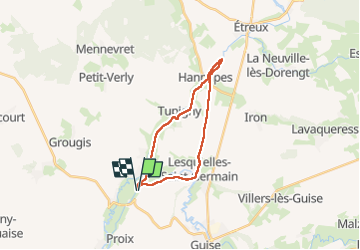
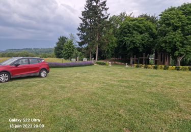
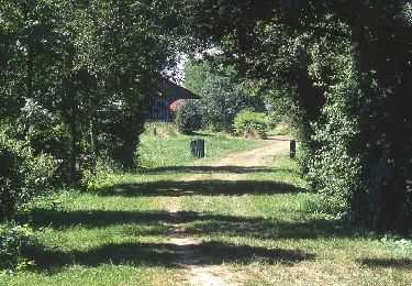
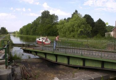
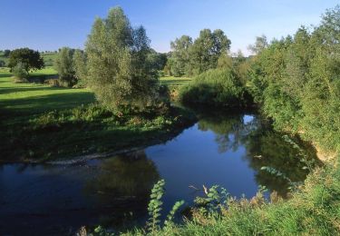
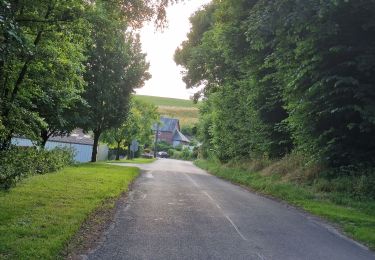
Tocht Stappen van 18,1 km beschikbaar op Hauts-de-France, Aisne, Vadencourt. Deze tocht wordt voorgesteld door alainwald.

Beschrijving

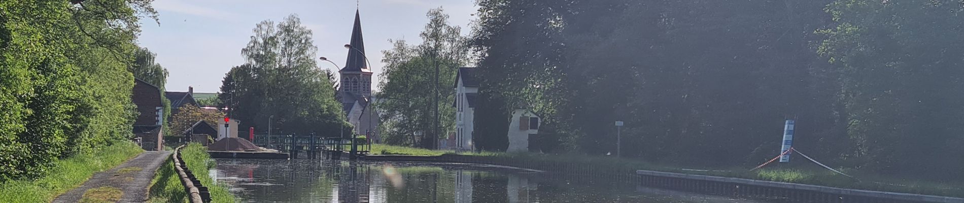
marche facile sur chemin large et canal de la sombre à l'oise

Hoogteprofiel

Foto's

Plaatsbepaling

Land:
France
Regio :
Hauts-de-France
Departement/Provincie :
Aisne
Gemeente :
Vadencourt
Locatie:
Unknown
Vertrek:(UTM)
541640 ; 5530182 (31U) N.

Wandeltochten in de omgeving

Tocht Stappen Proix - la valette par le nouveau circuit - Photo
Stappen
alainwald

Stappen

Gemakkelijk
Proix, Hauts-de-France, Aisne, France
15,8 km | 18,5 km-effort
3h 49min
Ja
Tocht Stappen Guise - Guise - Photo
Stappen
mjh

Stappen

Gemakkelijk
Guise, Hauts-de-France, Aisne, France
10,9 km | 12,7 km-effort
2h 41min
Ja
Tocht Stappen Proix - tour 2 la valette - Photo
Stappen
alainwald

Stappen

Gemakkelijk
Proix, Hauts-de-France, Aisne, France
15,3 km | 18,1 km-effort
4h 42min
Ja
Tocht Stappen Guise - Axe vert de Thiérache 1 - Photo
Stappen
tracegps

Stappen

Moeilijk
Guise, Hauts-de-France, Aisne, France
13,3 km | 15,2 km-effort
5h 0min
Neen
Tocht Stappen Vadencourt - La rigole - Photo
Stappen
tracegps

Stappen

Medium
Vadencourt, Hauts-de-France, Aisne, France
8,3 km | 9,8 km-effort
2h 15min
Ja
Tocht Stappen Guise - La Salette - Photo
Stappen
tracegps

Stappen

Zeer moeilijk
Guise, Hauts-de-France, Aisne, France
15,5 km | 18,3 km-effort
4h 15min
Ja
Tocht Stappen Guise - La Ferme-de-l'étang - Photo
Stappen
tracegps

Stappen

Zeer moeilijk
Guise, Hauts-de-France, Aisne, France
18,1 km | 21 km-effort
5h 30min
Ja
Tocht Stappen Proix - parcours la salette (proix) - Photo
Stappen
alainwald

Stappen

Gemakkelijk
Proix, Hauts-de-France, Aisne, France
14,5 km | 17 km-effort
3h 39min
Ja
Tocht Stappen Tupigny - tupigny - Photo
Stappen
alainwald

Stappen

Gemakkelijk
Tupigny, Hauts-de-France, Aisne, France
14,3 km | 16,9 km-effort
3h 41min
Ja


Sluiten
Mijn abonnementen