


2022 05 20 de luminy à calanque de sugiton

hal2012
Gebruiker

Lengte
3,2 km

Max. hoogte
218 m

Positief hoogteverschil
72 m
Km-Effort
4,5 km

Min. hoogte
32 m

Negatief hoogteverschil
164 m
Boucle
Neen
Datum van aanmaak :
2022-05-20 05:47:16.887
Laatste wijziging :
2022-05-22 20:01:49.88
1h12
Moeilijkheid : Medium

Gratisgps-wandelapplicatie
 SityTrail
IGN / Geografische instituten
SityTrail Plus
De wereld gaat voor u open
Over ons
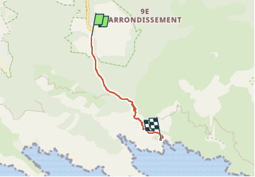
Tocht Stappen van 3,2 km beschikbaar op Provence-Alpes-Côte d'Azur, Bouches-du-Rhône, Marseille. Deze tocht wordt voorgesteld door hal2012.
Plaatsbepaling
Land:
France
Regio :
Provence-Alpes-Côte d'Azur
Departement/Provincie :
Bouches-du-Rhône
Gemeente :
Marseille
Locatie:
9e Arrondissement
Vertrek:(Dec)
Vertrek:(UTM)
697899 ; 4789284 (31T) N.
Opmerkingen