


Crazy Trott | 8. Anhée - Haut-le-Wastia

Romain François
Gebruiker
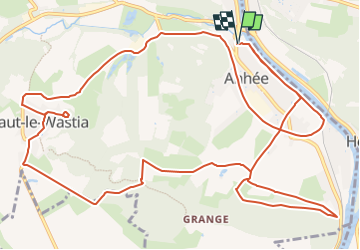

Lengte
16,6 km

Max. hoogte
247 m

Positief hoogteverschil
294 m
Km-Effort
21 km

Min. hoogte
84 m

Negatief hoogteverschil
294 m
Boucle
Ja
Datum van aanmaak :
2022-06-11 14:59:27.568
Laatste wijziging :
2022-07-07 10:47:23.784
1h00
Moeilijkheid : Gemakkelijk

Gratisgps-wandelapplicatie
 SityTrail
IGN / Geografische instituten
SityTrail Plus
De wereld gaat voor u open
Over ons
Tocht Mountainbike van 16,6 km beschikbaar op Wallonië, Namen, Anhée. Deze tocht wordt voorgesteld door Romain François.
Foto's


POI's


Plaatsbepaling
Land:
Belgium
Regio :
Wallonië
Departement/Provincie :
Namen
Gemeente :
Anhée
Locatie:
Unknown
Vertrek:(Dec)
Vertrek:(UTM)
633573 ; 5575228 (31U) N.
Opmerkingen