


GR10T13/7/22

LouisROGER
Gebruiker GUIDE
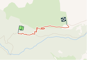

Lengte
2,3 km

Max. hoogte
1612 m

Positief hoogteverschil
392 m
Km-Effort
6,3 km

Min. hoogte
1219 m

Negatief hoogteverschil
14 m
Boucle
Neen
Datum van aanmaak :
2022-07-13 08:12:06.691
Laatste wijziging :
2022-07-14 16:48:55.806
3h52
Moeilijkheid : Medium

Gratisgps-wandelapplicatie
 SityTrail
IGN / Geografische instituten
SityTrail Plus
De wereld gaat voor u open
Over ons
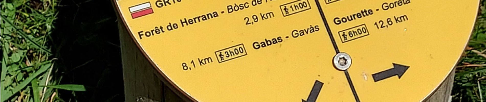
Tocht Stappen van 2,3 km beschikbaar op Nieuw-Aquitanië, Pyrénées-Atlantiques, Laruns. Deze tocht wordt voorgesteld door LouisROGER.
Foto's


Plaatsbepaling
Land:
France
Regio :
Nieuw-Aquitanië
Departement/Provincie :
Pyrénées-Atlantiques
Gemeente :
Laruns
Locatie:
Unknown
Vertrek:(Dec)
Vertrek:(UTM)
711352 ; 4754014 (30T) N.
Opmerkingen