


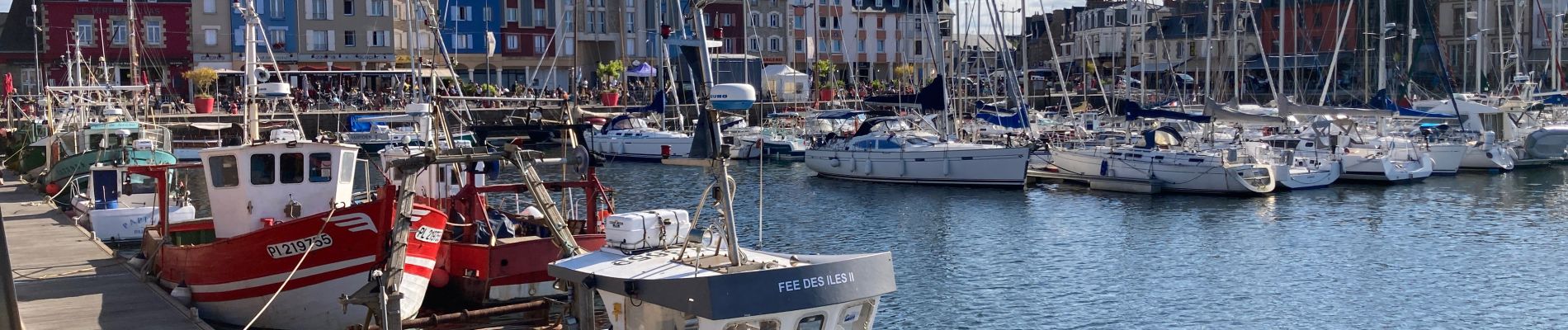
Boucle Port de Paimpol pointe de Guilben

ash
Gebruiker
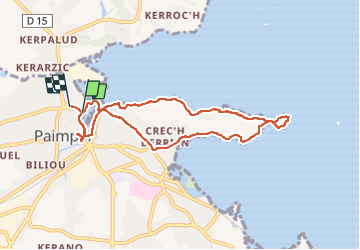

Lengte
7,8 km

Max. hoogte
30 m

Positief hoogteverschil
80 m
Km-Effort
8,8 km

Min. hoogte
-1 m

Negatief hoogteverschil
79 m
Boucle
Ja
Datum van aanmaak :
2022-07-26 14:50:02.0
Laatste wijziging :
2022-07-26 17:36:23.327
1h50
Moeilijkheid : Gemakkelijk

Gratisgps-wandelapplicatie
 SityTrail
IGN / Geografische instituten
SityTrail Plus
De wereld gaat voor u open
Over ons
Tocht Stappen van 7,8 km beschikbaar op Bretagne, Côtes-d'Armor, Paimpol. Deze tocht wordt voorgesteld door ash.
Foto's


Plaatsbepaling
Land:
France
Regio :
Bretagne
Departement/Provincie :
Côtes-d'Armor
Gemeente :
Paimpol
Locatie:
Unknown
Vertrek:(Dec)
Vertrek:(UTM)
496707 ; 5403230 (30U) N.
Opmerkingen