


20140911 Rando CVA Vercors Theorique Opt02 GV

holtzv
Gebruiker GUIDE
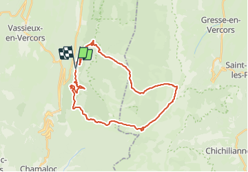

Lengte
34 km

Max. hoogte
1931 m

Positief hoogteverschil
1234 m
Km-Effort
51 km

Min. hoogte
976 m

Negatief hoogteverschil
1237 m
Boucle
Ja
Datum van aanmaak :
2014-12-10 00:00:00.0
Laatste wijziging :
2014-12-10 00:00:00.0
6h05
Moeilijkheid : Onbekend

Gratisgps-wandelapplicatie
 SityTrail
IGN / Geografische instituten
SityTrail Plus
De wereld gaat voor u open
Over ons
Tocht Paard van 34 km beschikbaar op Auvergne-Rhône-Alpes, Drôme, Saint-Agnan-en-Vercors. Deze tocht wordt voorgesteld door holtzv.
Plaatsbepaling
Land:
France
Regio :
Auvergne-Rhône-Alpes
Departement/Provincie :
Drôme
Gemeente :
Saint-Agnan-en-Vercors
Locatie:
Unknown
Vertrek:(Dec)
Vertrek:(UTM)
691270 ; 4971350 (31T) N.
Opmerkingen