


Angoustrine

taguette
Gebruiker

Lengte
10,3 km

Max. hoogte
1717 m

Positief hoogteverschil
426 m
Km-Effort
16 km

Min. hoogte
1346 m

Negatief hoogteverschil
427 m
Boucle
Ja
Datum van aanmaak :
2022-09-17 06:45:06.378
Laatste wijziging :
2022-09-17 09:54:43.615
2h49
Moeilijkheid : Medium

Gratisgps-wandelapplicatie
 SityTrail
IGN / Geografische instituten
SityTrail Plus
De wereld gaat voor u open
Over ons
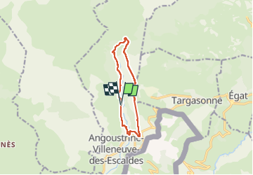
Tocht Stappen van 10,3 km beschikbaar op Occitanië, Pyrénées-Orientales, Angoustrine-Villeneuve-des-Escaldes. Deze tocht wordt voorgesteld door taguette.
Plaatsbepaling
Land:
France
Regio :
Occitanië
Departement/Provincie :
Pyrénées-Orientales
Gemeente :
Angoustrine-Villeneuve-des-Escaldes
Locatie:
Unknown
Vertrek:(Dec)
Vertrek:(UTM)
414513 ; 4705464 (31T) N.
Opmerkingen