


Itxassou

LouisROGER
Gebruiker GUIDE
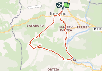

Lengte
9,1 km

Max. hoogte
362 m

Positief hoogteverschil
391 m
Km-Effort
14,3 km

Min. hoogte
40 m

Negatief hoogteverschil
391 m
Boucle
Ja
Datum van aanmaak :
2022-09-23 07:51:46.852
Laatste wijziging :
2022-09-26 09:55:01.63
4h49
Moeilijkheid : Moeilijk

Gratisgps-wandelapplicatie
 SityTrail
IGN / Geografische instituten
SityTrail Plus
De wereld gaat voor u open
Over ons
Tocht Stappen van 9,1 km beschikbaar op Nieuw-Aquitanië, Pyrénées-Atlantiques, Itxassou. Deze tocht wordt voorgesteld door LouisROGER.
Plaatsbepaling
Land:
France
Regio :
Nieuw-Aquitanië
Departement/Provincie :
Pyrénées-Atlantiques
Gemeente :
Itxassou
Locatie:
Unknown
Vertrek:(Dec)
Vertrek:(UTM)
629202 ; 4799194 (30T) N.
Opmerkingen