


Ardèche tour de Laboule

c.gourme
Gebruiker

Lengte
12,6 km

Max. hoogte
699 m

Positief hoogteverschil
544 m
Km-Effort
19,9 km

Min. hoogte
483 m

Negatief hoogteverschil
545 m
Boucle
Ja
Datum van aanmaak :
2022-10-02 07:31:13.0
Laatste wijziging :
2022-10-02 14:05:27.519
5h49
Moeilijkheid : Medium

Gratisgps-wandelapplicatie
 SityTrail
IGN / Geografische instituten
SityTrail Plus
De wereld gaat voor u open
Over ons
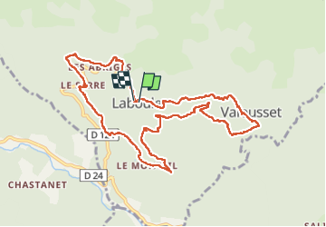
Tocht Stappen van 12,6 km beschikbaar op Auvergne-Rhône-Alpes, Ardèche, Laboule. Deze tocht wordt voorgesteld door c.gourme.
Plaatsbepaling
Land:
France
Regio :
Auvergne-Rhône-Alpes
Departement/Provincie :
Ardèche
Gemeente :
Laboule
Locatie:
Unknown
Vertrek:(Dec)
Vertrek:(UTM)
592534 ; 4937807 (31T) N.
Opmerkingen