


La font de Mai

sebbrunie1
Gebruiker
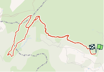

Lengte
7,8 km

Max. hoogte
371 m

Positief hoogteverschil
253 m
Km-Effort
11,1 km

Min. hoogte
226 m

Negatief hoogteverschil
253 m
Boucle
Ja
Datum van aanmaak :
2022-10-23 09:31:28.0
Laatste wijziging :
2022-10-23 18:36:09.602
3h27
Moeilijkheid : Medium

Gratisgps-wandelapplicatie
 SityTrail
IGN / Geografische instituten
SityTrail Plus
De wereld gaat voor u open
Over ons
Tocht Stappen van 7,8 km beschikbaar op Provence-Alpes-Côte d'Azur, Bouches-du-Rhône, Aubagne. Deze tocht wordt voorgesteld door sebbrunie1.
Plaatsbepaling
Land:
France
Regio :
Provence-Alpes-Côte d'Azur
Departement/Provincie :
Bouches-du-Rhône
Gemeente :
Aubagne
Locatie:
Unknown
Vertrek:(Dec)
Vertrek:(UTM)
706434 ; 4798868 (31T) N.
Opmerkingen