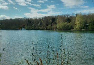
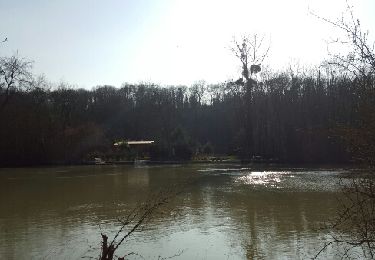
Tocht Stappen Trilport - Les terres de Chilperic au départ de Trilport - Photo

Les terres de Chilperic au départ de Trilport

 vitius
vitius

Gebruiker

© OpenStreetMap contributors
Lengte
Lengte
14,5 km
Max. hoogte
Max. hoogte
88 m
Positief hoogteverschil
114 m
Km-Effort
Km-Effort  
16 km
Min. hoogte
Min. hoogte
44 m
Negatief hoogteverschil
114 m
Boucle
Boucle
Ja
Datum van aanmaak :
2022-12-05 07:28:47.688
Laatste wijziging :
2022-12-05 07:37:34.577

(0 Bericht)

Stappen
Stappen
3h47
Moeilijkheid : Moeilijk

Scan deze QR-code om de tocht te openen in de SityTrail-applicatie

Gratisgps-wandelapplicatie

Logo SityTrail SityTrail

IGN / Geografische instituten

SityTrail uit de App Store downloaden SityTrail uit Google Play downloaden

Logo SityTrail SityTrail World

De wereld gaat voor u open

SityTrail uit de App Store downloaden SityTrail uit Google Play downloaden SityTrail op Huawei AppGallery downloaden

Over ons

Tocht Stappen van 14,5 km beschikbaar op Île-de-France, Seine-et-Marne, Trilport. Deze tocht wordt voorgesteld door vitius.

Hoogteprofiel

POI's

POI Trilport - Voie ferrée - Photo
vitius
TRILPORT 
POI Germigny-l'Évêque - Laie de Dancy - Photo
vitius
GERMIGNY-L'ÉVÊQUE 
POI Germigny-l'Évêque - Carrefour de la Marche - Photo
vitius
GERMIGNY-L'ÉVÊQUE 
POI Germigny-l'Évêque - Bifurcation - Photo
vitius
GERMIGNY-L'ÉVÊQUE 
POI Germigny-l'Évêque - Fond de l'Épine derrière le parc du Chateau - Photo
vitius
POI Varreddes - Pont sur la - Photo
vitius
VARREDDES 
POI Varreddes - Chemin au bord de la - Photo
vitius
POI Varreddes - Déversoir du - Photo
vitius
VARREDDES 
POI Poincy - Pont sur le - Photo
vitius
POINCY 
POI Poincy - Moulin de Poincy - Photo
vitius

Plaatsbepaling

Land:
France
Regio :
Île-de-France
Departement/Provincie :
Seine-et-Marne
Gemeente :
Trilport
Locatie:
Unknown
Vertrek:(UTM)
496290 ; 5423050 (31U) N.

Wandeltochten in de omgeving

Tocht Mountainbike Nanteuil-lès-Meaux - tite boucle Nanteuil par l'eau - Photo
Mountainbike
benbass77

Mountainbike

Gemakkelijk
(1)
Nanteuil-lès-Meaux, Île-de-France, Seine-et-Marne, France
23 km | 26 km-effort
1h 48min
Ja
Tocht Stappen Meaux - SM_MEAUX_LePâtis_8km. - Photo
Stappen
GR77LP

Stappen

Gemakkelijk
(3)
Meaux, Île-de-France, Seine-et-Marne, France
7,9 km | 8,4 km-effort
1h 54min
Ja
Tocht Stappen Meaux - Canal autour de Meaux - Photo
Stappen
Emmanuel1971

Stappen

Gemakkelijk
(1)
Meaux, Île-de-France, Seine-et-Marne, France
11,4 km | 12,3 km-effort
2h 51min
Ja
Tocht Stappen Chambry - Chambry Grand Parcours - Photo
Stappen
CC.RIDER

Stappen

Gemakkelijk
(2)
Chambry, Île-de-France, Seine-et-Marne, France
18,3 km | 20 km-effort
4h 29min
Ja
Tocht Stappen Germigny-l'Évêque - ballade en forêt de montceaux - Photo
Stappen
olivier77580

Stappen

Heel gemakkelijk
(1)
Germigny-l'Évêque, Île-de-France, Seine-et-Marne, France
5 km | 5,8 km-effort
1h 23min
Ja
Tocht Lopen Meaux - Meaux Condorcet - Photo
Lopen
32mike32

Lopen

Heel gemakkelijk
(2)
Meaux, Île-de-France, Seine-et-Marne, France
11,5 km | 12,5 km-effort
1h 0min
Ja
Tocht Lopen Mareuil-lès-Meaux - Collège Nanteuil - Photo
Lopen
32mike32

Lopen

Heel gemakkelijk
(1)
Mareuil-lès-Meaux, Île-de-France, Seine-et-Marne, France
10,3 km | 11,6 km-effort
1h 0min
Ja
Tocht Stappen Meaux - Le Parc naturel du Pâtis - Photo
Stappen
Tournan

Stappen

Gemakkelijk
(1)
Meaux, Île-de-France, Seine-et-Marne, France
12,5 km | 13,4 km-effort
2h 58min
Ja
Tocht Stappen Meaux - Meaux - Photo
Stappen
PatRando

Stappen

Gemakkelijk
Meaux, Île-de-France, Seine-et-Marne, France
8,2 km | 8,7 km-effort
1h 56min
Ja


Sluiten
Mijn abonnementen