


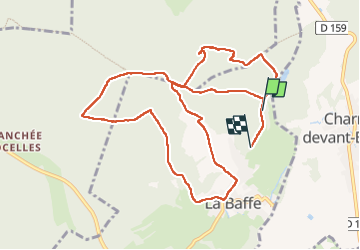
Balade à la Baffe !

Regisconraud
Gebruiker

Lengte
11 km

Max. hoogte
456 m

Positief hoogteverschil
170 m
Km-Effort
13,2 km

Min. hoogte
393 m

Negatief hoogteverschil
175 m
Boucle
Neen
Datum van aanmaak :
2022-12-28 10:36:33.626
Laatste wijziging :
2022-12-28 13:40:42.236
3h03
Moeilijkheid : Moeilijk

Gratisgps-wandelapplicatie
 SityTrail
IGN / Geografische instituten
SityTrail Plus
De wereld gaat voor u open
Over ons
Tocht Stappen van 11 km beschikbaar op Grand Est, Vogezen, La Baffe. Deze tocht wordt voorgesteld door Regisconraud.
Plaatsbepaling
Land:
France
Regio :
Grand Est
Departement/Provincie :
Vogezen
Gemeente :
La Baffe
Locatie:
Unknown
Vertrek:(Dec)
Vertrek:(UTM)
319856 ; 5338159 (32U) N.
Opmerkingen