Tocht Stappen Aubais - Aubais-junas-moulin_de_corbières - Photo

Aubais-junas-moulin_de_corbières

 v.rabot
v.rabot

Gebruiker

© OpenStreetMap contributors
Lengte
Lengte
15,5 km
Max. hoogte
Max. hoogte
97 m
Positief hoogteverschil
210 m
Km-Effort
Km-Effort  
18,3 km
Min. hoogte
Min. hoogte
31 m
Negatief hoogteverschil
210 m
Boucle
Boucle
Ja
Datum van aanmaak :
2023-01-05 08:34:11.639
Laatste wijziging :
2023-01-05 15:15:37.776

(0 Bericht)

Stappen
Stappen
5h00
Moeilijkheid : Medium

Scan deze QR-code om de tocht te openen in de SityTrail-applicatie

Gratisgps-wandelapplicatie

Logo SityTrail SityTrail

IGN / Geografische instituten

SityTrail uit de App Store downloaden SityTrail uit Google Play downloaden

Logo SityTrail SityTrail World

De wereld gaat voor u open

SityTrail uit de App Store downloaden SityTrail uit Google Play downloaden SityTrail op Huawei AppGallery downloaden

Over ons

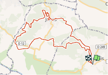
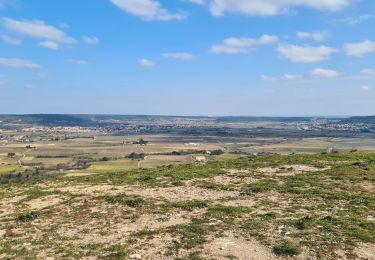
Tocht Stappen van 15,5 km beschikbaar op Occitanië, Gard, Aubais. Deze tocht wordt voorgesteld door v.rabot.

Beschrijving

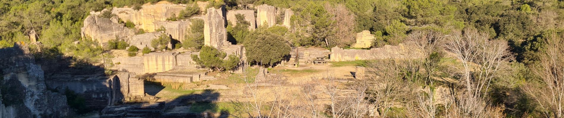
Parking près du cimetière, traverser Aubais pour rejoindre Junas, aucune difficulté sur l'ensemble du parcours, cependant faites attention par temps humide au risque de glisser sur les roches plates du chemin. J'ai essayé de montrer les points importants de la carrière mais prenez votre temps pour ne rien rater. Pour le moulin de corbières, malheureusement le panneau d'information a disparu, reportez vous sur ce lien : https://www.junas.fr/images/Mairie/TMJCHRISTIAN/moulincorbiere/moulin_corbiere_histoire.pdf, pour en comprendre le fonctionnement. Bonne rando

Hoogteprofiel

Foto's

33 fotos in totaal. Klik op een foto om ze allemaal in de galerij weer te geven.

Plaatsbepaling

Land:
France
Regio :
Occitanië
Departement/Provincie :
Gard
Gemeente :
Aubais
Locatie:
Unknown
Vertrek:(UTM)
592320 ; 4844963 (31T) N.

Wandeltochten in de omgeving

Tocht Stappen Sommières -  SOMMIERES 30 - VILLEVIEILLE châteaux- JUNAS les carrières  - Photo
Stappen
jeff66

Stappen

Medium
(2)
Sommières, Occitanië, Gard, France
14 km | 16,9 km-effort
2h 34min
Ja
Tocht Mountainbike Villetelle - Grande Traversée de l'Hérault à VTT - De Ambrussum à Fondespierre - Photo
Mountainbike
tracegps

Mountainbike

Medium
(2)
Villetelle, Occitanië, Hérault, France
29 km | 33 km-effort
3h 30min
Neen
Tocht Mountainbike Calvisson - Espace VTT-FFC Pays de Sommières n°7 - Les Châteaux du Sommiérois - Photo
Mountainbike
tracegps

Mountainbike

Moeilijk
(1)
Calvisson, Occitanië, Gard, France
42 km | 50 km-effort
3h 30min
Ja
Tocht Stappen Junas - Entre Junas et Aujargues - Photo
Stappen
GUIDE
randotines

Stappen

Gemakkelijk
Junas, Occitanië, Gard, France
7,9 km | 9,4 km-effort
2h 2min
Ja
Tocht Paard Gallargues-le-Montueux - Aujargues - Photo
Paard
N-Letessier

Paard

Gemakkelijk
(1)
Gallargues-le-Montueux, Occitanië, Gard, France
28 km | 32 km-effort
5h 33min
Ja
Tocht Stappen Sommières - Autour de Villevielle 30 - Photo
Stappen
guignier

Stappen

Gemakkelijk
(2)
Sommières, Occitanië, Gard, France
10,5 km | 12,3 km-effort
3h 0min
Ja
Tocht Stappen Junas - Aubais  - Photo
Stappen
Galoche

Stappen

Heel gemakkelijk
Junas, Occitanië, Gard, France
6,4 km | 7,8 km-effort
1h 39min
Ja
Tocht Stappen Sommières - Les matches de géants  - Photo
Stappen
gscholasch

Stappen

Gemakkelijk
Sommières, Occitanië, Gard, France
48 km | 67 km-effort
3h 29min
Neen
Tocht Stappen Congénies - congenies-lemazet-calvisson - Photo
Stappen
v.rabot

Stappen

Medium
Congénies, Occitanië, Gard, France
16,9 km | 21 km-effort
5h 0min
Ja


Sluiten
Mijn abonnementen