Tocht Andere activiteiten Castellero - test mco - Photo
 UMNIT
UMNIT

Gebruiker

© OpenStreetMap contributors
Lengte
Lengte
80 km
Max. hoogte
Max. hoogte
321 m
Positief hoogteverschil
1014 m
Km-Effort
Km-Effort  
94 km
Min. hoogte
Min. hoogte
83 m
Negatief hoogteverschil
920 m
Boucle
Boucle
Neen
Datum van aanmaak :
2014-12-10 00:00:00.0
Laatste wijziging :
2014-12-10 00:00:00.0

(0 Bericht)

Andere activiteiten
Andere activiteiten
5m
Moeilijkheid : Onbekend

Scan deze QR-code om de tocht te openen in de SityTrail-applicatie

Gratisgps-wandelapplicatie

Logo SityTrail SityTrail

IGN / Geografische instituten

SityTrail uit de App Store downloaden SityTrail uit Google Play downloaden

Logo SityTrail SityTrail World

De wereld gaat voor u open

SityTrail uit de App Store downloaden SityTrail uit Google Play downloaden SityTrail op Huawei AppGallery downloaden

Over ons

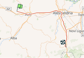
Tocht Andere activiteiten van 80 km beschikbaar op Piëmont, Asti, Castellero. Deze tocht wordt voorgesteld door UMNIT.

Hoogteprofiel

Foto's

POI's

POI Menconico - test - Photo
UMNIT
MENCONICO 

Plaatsbepaling

Land:
Italy
Regio :
Piëmont
Departement/Provincie :
Asti
Gemeente :
Castellero
Locatie:
Unknown
Vertrek:(Dec)
Vertrek:(UTM)
427104 ; 4974920 (32T) N.

Wandeltochten in de omgeving

Tocht Te voet Castellero - Sentiero della nocciola Nord/est - Photo
Te voet
PRO

Te voet

Gemakkelijk
Castellero, Piëmont, Asti, Italy
4,2 km | 5,8 km-effort
1h 18min
Neen
Tocht Te voet Castellero - Sentiero della Nocciola - Photo
Te voet
PRO

Te voet

Gemakkelijk
Castellero, Piëmont, Asti, Italy
4,7 km | 5,9 km-effort
1h 20min
Ja


Sluiten
Mijn abonnementen