


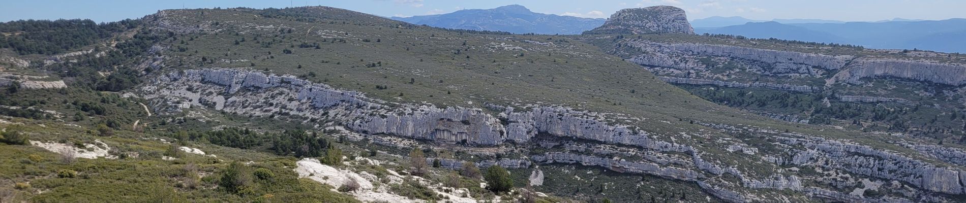
le pic du Taoumé par Pichauris

amiral13
Gebruiker GUIDE
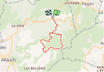

Lengte
13,3 km

Max. hoogte
689 m

Positief hoogteverschil
507 m
Km-Effort
20 km

Min. hoogte
309 m

Negatief hoogteverschil
507 m
Boucle
Ja
Datum van aanmaak :
2023-04-09 08:54:25.565
Laatste wijziging :
2023-04-11 06:12:45.488
4h32
Moeilijkheid : Gemakkelijk

Gratisgps-wandelapplicatie
 SityTrail
IGN / Geografische instituten
SityTrail Plus
De wereld gaat voor u open
Over ons
Tocht Stappen van 13,3 km beschikbaar op Provence-Alpes-Côte d'Azur, Bouches-du-Rhône, Allauch. Deze tocht wordt voorgesteld door amiral13.
Beschrijving
un beau point de vue.
La baume Sourne n'est plus accessible afin de protéger une espèce de chauve-souris.
La plupart des sources sont à sec.
Foto's


Plaatsbepaling
Land:
France
Regio :
Provence-Alpes-Côte d'Azur
Departement/Provincie :
Bouches-du-Rhône
Gemeente :
Allauch
Locatie:
Unknown
Vertrek:(Dec)
Vertrek:(UTM)
705467 ; 4805070 (31T) N.
Opmerkingen