


Congy du 09/04/2023

VANDERPUTTENMi
Gebruiker GUIDE
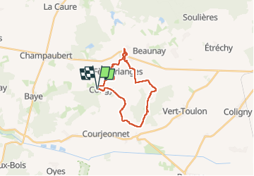

Lengte
19,8 km

Max. hoogte
241 m

Positief hoogteverschil
285 m
Km-Effort
24 km

Min. hoogte
143 m

Negatief hoogteverschil
286 m
Boucle
Ja
Datum van aanmaak :
2023-04-09 08:12:03.914
Laatste wijziging :
2023-04-09 17:28:00.142
5h21
Moeilijkheid : Zeer moeilijk

Gratisgps-wandelapplicatie
 SityTrail
IGN / Geografische instituten
SityTrail Plus
De wereld gaat voor u open
Over ons
Tocht Stappen van 19,8 km beschikbaar op Grand Est, Marne, Congy. Deze tocht wordt voorgesteld door VANDERPUTTENMi.
Beschrijving
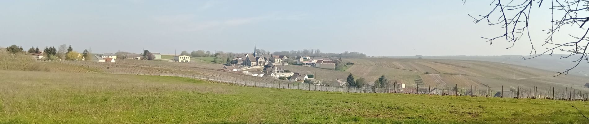
Congy - Etoges - Toulon la Montagne par le GRP° Thibaut de Champagne...
Foto's

Plaatsbepaling
Land:
France
Regio :
Grand Est
Departement/Provincie :
Marne
Gemeente :
Congy
Locatie:
Unknown
Vertrek:(Dec)
Vertrek:(UTM)
560631 ; 5412076 (31U) N.
Opmerkingen