Tocht Stappen Alrance - rafo ho - Photo
 machafla
machafla

Gebruiker

© OpenStreetMap contributors
Lengte
Lengte
17,4 km
Max. hoogte
Max. hoogte
943 m
Positief hoogteverschil
427 m
Km-Effort
Km-Effort  
23 km
Min. hoogte
Min. hoogte
732 m
Negatief hoogteverschil
427 m
Boucle
Boucle
Ja
Datum van aanmaak :
2023-05-08 06:29:30.096
Laatste wijziging :
2023-05-08 13:10:47.969

(0 Bericht)

Stappen
Stappen
4h10
Moeilijkheid : Medium

Scan deze QR-code om de tocht te openen in de SityTrail-applicatie

Gratisgps-wandelapplicatie

Logo SityTrail SityTrail

IGN / Geografische instituten

SityTrail uit de App Store downloaden SityTrail uit Google Play downloaden

Logo SityTrail SityTrail World

De wereld gaat voor u open

SityTrail uit de App Store downloaden SityTrail uit Google Play downloaden SityTrail op Huawei AppGallery downloaden

Over ons

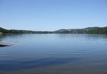
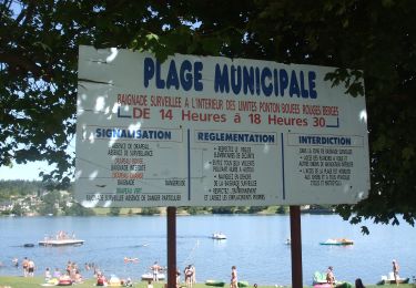
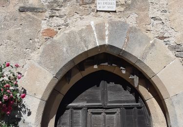
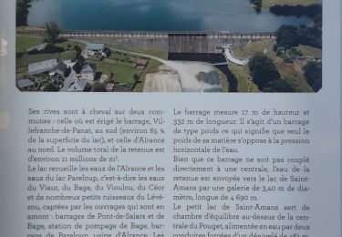
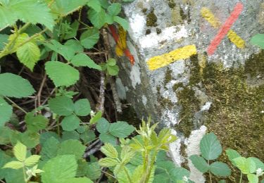
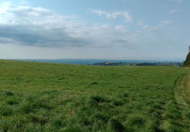
Tocht Stappen van 17,4 km beschikbaar op Occitanië, Aveyron, Alrance. Deze tocht wordt voorgesteld door machafla.

Beschrijving

rando gourmande Alrance

Hoogteprofiel

Plaatsbepaling

Land:
France
Regio :
Occitanië
Departement/Provincie :
Aveyron
Gemeente :
Alrance
Locatie:
Unknown
Vertrek:(Dec)
Vertrek:(UTM)
474806 ; 4886485 (31T) N.

Wandeltochten in de omgeving

Tocht Te voet Auriac-Lagast - Ronde des lacs du Levezou - Photo
Te voet
PRO

Te voet

Zeer moeilijk
Auriac-Lagast, Occitanië, Aveyron, France
103 km | 135 km-effort
30h 36min
Ja
Tocht Te voet Alrance - Circumlacustre Villefranche-de-Panat - Photo
Te voet
PRO

Te voet

Gemakkelijk
Alrance, Occitanië, Aveyron, France
10,2 km | 11,7 km-effort
2h 39min
Ja
Tocht Stappen Villefranche-de-Panat - Villefranche de Panat - Photo
Stappen
christiane01

Stappen

Gemakkelijk
(2)
Villefranche-de-Panat, Occitanië, Aveyron, France
10,4 km | 11,9 km-effort
2h 42min
Ja
Tocht Stappen Villefranche-de-Panat - Villefranche de Panat à Salles Curan  - Photo
Stappen
yvesmonteillet

Stappen

Zeer moeilijk
Villefranche-de-Panat, Occitanië, Aveyron, France
24 km | 31 km-effort
4h 53min
Neen
Tocht Stappen Villefranche-de-Panat - randonnée Villefranche de panat  - Photo
Stappen
Pascal Lemaire

Stappen

Moeilijk
Villefranche-de-Panat, Occitanië, Aveyron, France
10,2 km | 12,7 km-effort
3h 10min
Ja
Tocht Stappen Villefranche-de-Panat - lac de Villefranche de panat  - Photo
Stappen
yvesmonteillet

Stappen

Medium
Villefranche-de-Panat, Occitanië, Aveyron, France
10,3 km | 11,8 km-effort
1h 46min
Ja
Tocht Stappen Villefranche-de-Panat - Bosc Marty  - Photo
Stappen
yvesmonteillet

Stappen

Gemakkelijk
Villefranche-de-Panat, Occitanië, Aveyron, France
4,6 km | 5,6 km-effort
1h 15min
Ja
Tocht Mountainbike Villefranche-de-Panat - St Jean le froid  - Photo
Mountainbike
CASSISFRAMBOISE

Mountainbike

Zeer moeilijk
Villefranche-de-Panat, Occitanië, Aveyron, France
34 km | 44 km-effort
3h 7min
Ja
Tocht Stappen Villefranche-de-Panat - Ville franche de Panat  - Photo
Stappen
pajweb

Stappen

Medium
Villefranche-de-Panat, Occitanië, Aveyron, France
10,4 km | 11,9 km-effort
2h 50min
Ja


Sluiten
Mijn abonnementen