


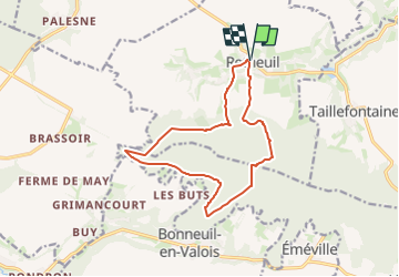
Retheuil > boucle forêt

DA FT
Gebruiker

Lengte
12,8 km

Max. hoogte
246 m

Positief hoogteverschil
312 m
Km-Effort
16,9 km

Min. hoogte
80 m

Negatief hoogteverschil
312 m
Boucle
Ja
Datum van aanmaak :
2023-06-05 10:48:07.218
Laatste wijziging :
2023-06-05 10:58:28.024
3h50
Moeilijkheid : Moeilijk

Gratisgps-wandelapplicatie
 SityTrail
IGN / Geografische instituten
SityTrail Plus
De wereld gaat voor u open
Over ons
Tocht Stappen van 12,8 km beschikbaar op Hauts-de-France, Aisne, Retheuil. Deze tocht wordt voorgesteld door DA FT.
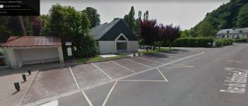
Foto's


Plaatsbepaling
Land:
France
Regio :
Hauts-de-France
Departement/Provincie :
Aisne
Gemeente :
Retheuil
Locatie:
Unknown
Vertrek:(Dec)
Vertrek:(UTM)
500685 ; 5463263 (31U) N.
Opmerkingen