


2014-12-21 Picnic CVA Mt Ste Odile

holtzv
Gebruiker GUIDE
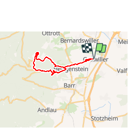

Lengte
19,3 km

Max. hoogte
774 m

Positief hoogteverschil
639 m
Km-Effort
28 km

Min. hoogte
166 m

Negatief hoogteverschil
639 m
Boucle
Ja
Datum van aanmaak :
2014-12-16 00:00:00.0
Laatste wijziging :
2014-12-16 00:00:00.0
3h24
Moeilijkheid : Medium

Gratisgps-wandelapplicatie
 SityTrail
IGN / Geografische instituten
SityTrail Plus
De wereld gaat voor u open
Over ons
Tocht Paard van 19,3 km beschikbaar op Grand Est, Bas-Rhin, Goxwiller. Deze tocht wordt voorgesteld door holtzv.
Plaatsbepaling
Land:
France
Regio :
Grand Est
Departement/Provincie :
Bas-Rhin
Gemeente :
Goxwiller
Locatie:
Unknown
Vertrek:(Dec)
Vertrek:(UTM)
387796 ; 5365529 (32U) N.
Opmerkingen