


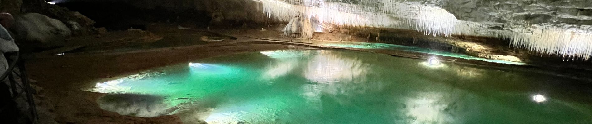
Grotte de Choranche Vercors

timiderte
Gebruiker
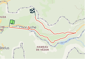

Lengte
8,1 km

Max. hoogte
587 m

Positief hoogteverschil
459 m
Km-Effort
13,2 km

Min. hoogte
258 m

Negatief hoogteverschil
166 m
Boucle
Neen
Datum van aanmaak :
2023-06-21 10:36:01.0
Laatste wijziging :
2023-06-29 18:21:17.917
3h03
Moeilijkheid : Moeilijk

Gratisgps-wandelapplicatie
 SityTrail
IGN / Geografische instituten
SityTrail Plus
De wereld gaat voor u open
Over ons
Tocht Stappen van 8,1 km beschikbaar op Auvergne-Rhône-Alpes, Isère, Choranche. Deze tocht wordt voorgesteld door timiderte.
Foto's


Plaatsbepaling
Land:
France
Regio :
Auvergne-Rhône-Alpes
Departement/Provincie :
Isère
Gemeente :
Choranche
Locatie:
Unknown
Vertrek:(Dec)
Vertrek:(UTM)
687216 ; 4993117 (31T) N.
Opmerkingen