


exp_20 juil. 2023 à 09-09-14.gpx - Tronçon 1

leboucherdaniel
Gebruiker
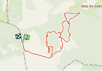

Lengte
15 km

Max. hoogte
737 m

Positief hoogteverschil
338 m
Km-Effort
19,5 km

Min. hoogte
527 m

Negatief hoogteverschil
335 m
Boucle
Ja
Datum van aanmaak :
2023-07-20 21:51:38.326
Laatste wijziging :
2023-07-20 21:51:38.326

Gratisgps-wandelapplicatie
 SityTrail
IGN / Geografische instituten
SityTrail Plus
De wereld gaat voor u open
Over ons
Tocht van 15 km beschikbaar op Occitanië, Aveyron, Nant. Deze tocht wordt voorgesteld door leboucherdaniel.
Plaatsbepaling
Land:
France
Regio :
Occitanië
Departement/Provincie :
Aveyron
Gemeente :
Nant
Locatie:
Unknown
Vertrek:(Dec)
Vertrek:(UTM)
518937 ; 4869433 (31T) N.
Opmerkingen