


2023 07 22

hal2012
Gebruiker

Lengte
2,9 km

Max. hoogte
59 m

Positief hoogteverschil
61 m
Km-Effort
3,7 km

Min. hoogte
2 m

Negatief hoogteverschil
70 m
Boucle
Ja
Datum van aanmaak :
2023-07-22 14:20:45.683
Laatste wijziging :
2023-07-24 17:33:30.047
1h23
Moeilijkheid : Gemakkelijk

Gratisgps-wandelapplicatie
 SityTrail
IGN / Geografische instituten
SityTrail Plus
De wereld gaat voor u open
Over ons
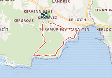
Tocht Stappen van 2,9 km beschikbaar op Bretagne, Finistère, Plogoff. Deze tocht wordt voorgesteld door hal2012.
Beschrijving
GR 34
Plaatsbepaling
Land:
France
Regio :
Bretagne
Departement/Provincie :
Finistère
Gemeente :
Plogoff
Locatie:
Unknown
Vertrek:(Dec)
Vertrek:(UTM)
377215 ; 5320957 (30U) N.
Opmerkingen