


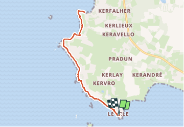
30/07/2023 - Pointe du Bile à Pénestin

babeth35
Gebruiker

Lengte
8,3 km

Max. hoogte
16 m

Positief hoogteverschil
71 m
Km-Effort
9,3 km

Min. hoogte
0 m

Negatief hoogteverschil
71 m
Boucle
Ja
Datum van aanmaak :
2023-07-30 13:18:08.0
Laatste wijziging :
2023-07-30 15:50:35.53
1h58
Moeilijkheid : Gemakkelijk

Gratisgps-wandelapplicatie
 SityTrail
IGN / Geografische instituten
SityTrail Plus
De wereld gaat voor u open
Over ons
Tocht Stappen van 8,3 km beschikbaar op Bretagne, Morbihan, Pénestin. Deze tocht wordt voorgesteld door babeth35.
Plaatsbepaling
Land:
France
Regio :
Bretagne
Departement/Provincie :
Morbihan
Gemeente :
Pénestin
Locatie:
Unknown
Vertrek:(Dec)
Vertrek:(UTM)
539114 ; 5254433 (30T) N.
Opmerkingen