Tocht Fiets Apt - Parcours n°8 - Apt - Photo

Randonnées de Vélo Loisir Provence GUIDE+

© OpenStreetMap contributors
Lengte
Lengte
27 km
Max. hoogte
Max. hoogte
415 m
Positief hoogteverschil
349 m
Km-Effort
Km-Effort  
32 km
Min. hoogte
Min. hoogte
219 m
Negatief hoogteverschil
349 m
Boucle
Boucle
Ja
Datum van aanmaak :
2015-01-07 00:00:00.0
Laatste wijziging :
2015-01-07 00:00:00.0

(0 Bericht)

Fiets
Fiets
1h50
Moeilijkheid : Medium

Scan deze QR-code om de tocht te openen in de SityTrail-applicatie

Gratisgps-wandelapplicatie

Logo SityTrail SityTrail

IGN / Geografische instituten

SityTrail uit de App Store downloaden SityTrail uit Google Play downloaden

Logo SityTrail SityTrail Plus

De wereld gaat voor u open

SityTrail uit de App Store downloaden SityTrail uit Google Play downloaden SityTrail op Huawei AppGallery downloaden

Over ons

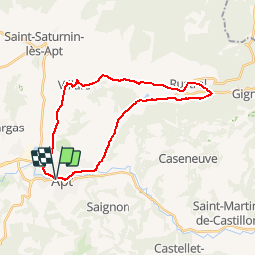
Tocht Fiets van 27 km beschikbaar op Provence-Alpes-Côte d'Azur, Vaucluse, Apt. Deze tocht wordt voorgesteld door Vélo Loisir Provence.

Beschrijving

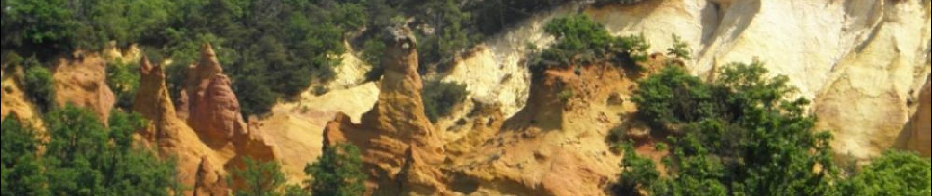
Discover the «Pays des ocres» with its various ochre quaries... Direction of the itinerary : Apt => Rustrel => Villars => Apt

Hoogteprofiel

Foto's

Plaatsbepaling

Land:
France
Regio :
Provence-Alpes-Côte d'Azur
Departement/Provincie :
Vaucluse
Gemeente :
Apt
Locatie:
Unknown
Vertrek:(Dec)
Vertrek:(UTM)
692282 ; 4860956 (31T) N.


Sluiten
Mijn abonnementen