


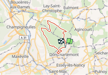

4,8 km | 6 km-effort


Gebruiker


Gratisgps-wandelapplicatie
 SityTrail
IGN / Geografische instituten
SityTrail World
De wereld gaat voor u open
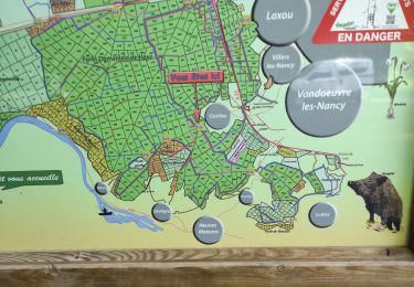
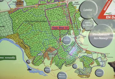
Tocht Noords wandelen van 10,1 km beschikbaar op Grand Est, Meurthe-et-Moselle, Dommartemont. Deze tocht wordt voorgesteld door DanielROLLET.
2023 08 07 - MND Saulxures Rando 54 - 15 participants
09h15 à 11h30 - Temps dégagé.
Attendu quelques retardataires...

Lopen

Te voet
Te voet

Stappen
Fietstoerisme
Stappen
Stappen
Stappen
Te voet