![](/images/other/stat-length.png)
![Tocht Stappen Chaumont-Gistoux - #230821 - Vieusart balade du Bruan - Photo](https://media.geolcdn.com/t/1900/400/ext.pjpeg?maxdim=2&url=https%3A%2F%2Fstatic1.geolcdn.com%2Fsiteimages%2Fupload%2Ffiles%2F1553511878bg_sport_marche.png)
#230821 - Vieusart balade du Bruan
Randos Ouvertes
Gebruiker
![Lengte](/images/other/stat-length.png)
![Max. hoogte](https://static1.geolcdn.com/siteimages/upload/files/1508320355ic_sort_altitude_max_24dp.png)
![Positief hoogteverschil](https://static1.geolcdn.com/siteimages/upload/files/1508320355ic_sort_den_pos_24dp.png)
![Km-Effort](/images/other/stat-length.png)
![Min. hoogte](https://static1.geolcdn.com/siteimages/upload/files/1508320355ic_sort_altitude_min_24dp.png)
![Negatief hoogteverschil](https://static1.geolcdn.com/siteimages/upload/files/1508320355ic_sort_den_neg_24dp.png)
![Boucle](https://static1.geolcdn.com/siteimages/upload/files/16400158638029165_repeat_loop_refresh_sync_direction_icon.png)
![Stappen](https://static1.geolcdn.com/sitytour/trail-icons/101.png)
1h29
Moeilijkheid : Medium
![Scan deze QR-code om de tocht te openen in de SityTrail-applicatie](https://capi.geolives.com/qq0zvz2zws4bq2lad0pu/sitytour/trails/3777556/qr.png?size=200)
Gratisgps-wandelapplicatie
Over ons
Tocht Stappen van 5,5 km beschikbaar op Wallonië, Waals-Brabant, Chaumont-Gistoux. Deze tocht wordt voorgesteld door Randos Ouvertes.
Beschrijving
Source circuit et commentaires : Bernard Horlay
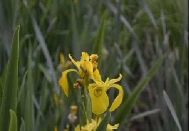
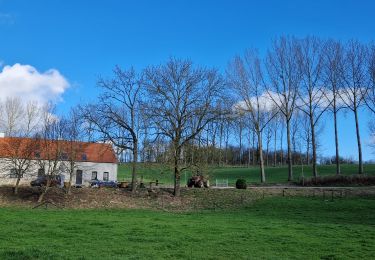
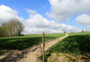
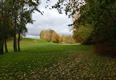
La promenade de près de 5,5 km vous emmènera par les étangs de Vieusart dans la vallée du Pisselet en direction de Dion-le-Mont, puis vous fera grimper pour atteindre le plateau agricole séparant Dion-le-Mont de Corroy-le-Grand. Vous terminerez la promenade en longeant la propriété de la famille de Dorlodot, propriétaire du splendide château que vous ne manquerez pas d’admirer au passage. Outre les oiseaux liés aux milieux humides, vous pourrez observer des espèces forestières et également des espèces de milieux plus ouverts.
La première moitié du parcours comporte un tronçon forestier qui peut s’avérer assez humide, puis des portiques très étroits pour traverser des prairies : la balade n’est donc pas praticable pour les poussettes et chaises roulantes. Les bottines de marche sont recommandées.
Plaatsbepaling
Opmerkingen
Wandeltochten in de omgeving
![Tocht Stappen Ottignies-Louvain-la-Neuve - Nuit du scoutisme - Louvain-la-Neuve - Photo](https://media.geolcdn.com/t/375/260/ext.jpg?maxdim=2&url=https%3A%2F%2Fmedia.geolcdn.com%2Ff%2Fa66232ef-7471-42b4-b6aa-97b05d528647.jpg)
![Stappen Stappen](https://static1.geolcdn.com/sitytour/trail-icons/101.png)
Stappen
![](/images/other/stat-length.png)
![](https://static1.geolcdn.com/siteimages/upload/files/16400158638029165_repeat_loop_refresh_sync_direction_icon.png)
![Tocht Stappen Chaumont-Gistoux - De Dion-le Mont à Dion-le Val par la vallée du Pisselet - Photo](https://media.geolcdn.com/t/375/260/ext.jpg?maxdim=2&url=https%3A%2F%2Fstatic1.geolcdn.com%2Fsiteimages%2Fupload%2Ffiles%2F1553511878bg_sport_marche.png)
![Stappen Stappen](https://static1.geolcdn.com/sitytour/trail-icons/101.png)
Stappen
![](/images/other/stat-length.png)
![](https://static1.geolcdn.com/siteimages/upload/files/16400158638029165_repeat_loop_refresh_sync_direction_icon.png)
![Tocht Stappen Ottignies-Louvain-la-Neuve - Balade dans le Bois de Lauzelle - Photo](https://media.geolcdn.com/t/375/260/ext.jpg?maxdim=2&url=https%3A%2F%2Fservices.sitytrail.com%2FGeolivesWS%2FDownloadMedia.ashx%3FTrailID%3D652718%26Media%3Dfe46824b-6e61-4100-b5d8-1f34a923c154.jpg)
![Stappen Stappen](https://static1.geolcdn.com/sitytour/trail-icons/101.png)
Stappen
![](/images/other/stat-length.png)
![](https://static1.geolcdn.com/siteimages/upload/files/16400158638029165_repeat_loop_refresh_sync_direction_icon.png)
![Tocht Stappen Ottignies-Louvain-la-Neuve - Lauzelle - Circuit Natura 2000, des sites qui valent le détour ! - Bw01 - Photo](https://media.geolcdn.com/t/375/260/ext.jpg?maxdim=2&url=https%3A%2F%2Fmedia.geolcdn.com%2Ff%2F648550f3-d9ef-4b6f-9933-939a57e593f5.JPG)
![Stappen Stappen](https://static1.geolcdn.com/sitytour/trail-icons/101.png)
Stappen
![](/images/other/stat-length.png)
![](https://static1.geolcdn.com/siteimages/upload/files/16400158638029165_repeat_loop_refresh_sync_direction_icon.png)
![Tocht Stappen Waver - RB-BW-07 - Des montagnes russes près de Wavre - Photo](https://media.geolcdn.com/t/375/260/ext.jpg?maxdim=2&url=https%3A%2F%2Fservices.sitytrail.com%2FGeolivesWS%2FDownloadMedia.ashx%3FTrailID%3D179582%26Media%3D72f18e5f-b96b-4732-9bbe-457fabd000c2.jpg)
![Stappen Stappen](https://static1.geolcdn.com/sitytour/trail-icons/101.png)
Stappen
![](/images/other/stat-length.png)
![](https://static1.geolcdn.com/siteimages/upload/files/16400158638029165_repeat_loop_refresh_sync_direction_icon.png)
![Tocht Stappen Chaumont-Gistoux - #240301 - Ocquière - Photo](https://media.geolcdn.com/t/375/260/ext.jpg?maxdim=2&url=https%3A%2F%2Fmedia.geolcdn.com%2Ff%2F23a7770d-5e35-45ed-9cb6-b2850e27c8e4.JPG)
![Stappen Stappen](https://static1.geolcdn.com/sitytour/trail-icons/101.png)
Stappen
![](/images/other/stat-length.png)
![](https://static1.geolcdn.com/siteimages/upload/files/16400158638029165_repeat_loop_refresh_sync_direction_icon.png)
![Tocht Stappen Chaumont-Gistoux - #231016 - Corroy-Le-Grand et le Val d'Ocquière*** (inversé court) - Photo](https://media.geolcdn.com/t/375/260/ext.jpg?maxdim=2&url=https%3A%2F%2Fmedia.geolcdn.com%2Ff%2Fb650de28-d96e-49f2-85c2-d640aecfc352.jpg)
![Stappen Stappen](https://static1.geolcdn.com/sitytour/trail-icons/101.png)
Stappen
![](/images/other/stat-length.png)
![](https://static1.geolcdn.com/siteimages/upload/files/16400158638029165_repeat_loop_refresh_sync_direction_icon.png)
![Tocht Stappen Chaumont-Gistoux - #210507 Dion-le-Mont, Pisselet et Louvranges - Photo](https://media.geolcdn.com/t/375/260/ext.jpg?maxdim=2&url=https%3A%2F%2Fmedia.geolcdn.com%2Ff%2Fd47a499a-2fb6-4522-b89e-f74658341ac6.JPG)
![Stappen Stappen](https://static1.geolcdn.com/sitytour/trail-icons/101.png)
Stappen
![](/images/other/stat-length.png)
![](https://static1.geolcdn.com/siteimages/upload/files/16400158638029165_repeat_loop_refresh_sync_direction_icon.png)
![Tocht Stappen Waver - #201030 - Wavre, Bois ste Anne, Golf, Parc des Saules et Orangerie - Photo](https://media.geolcdn.com/t/375/260/ext.jpg?maxdim=2&url=https%3A%2F%2Fmedia.geolcdn.com%2Ff%2F31b99882-a43b-4241-afb6-782440f970fa.JPG)
![Stappen Stappen](https://static1.geolcdn.com/sitytour/trail-icons/101.png)
Stappen
![](/images/other/stat-length.png)
![](https://static1.geolcdn.com/siteimages/upload/files/16400158638029165_repeat_loop_refresh_sync_direction_icon.png)
gueuur