


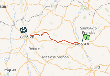
Camino 1 étape 22 du 16.08.2023

bene_dictus77
Gebruiker

Lengte
26 km

Max. hoogte
197 m

Positief hoogteverschil
456 m
Km-Effort
33 km

Min. hoogte
77 m

Negatief hoogteverschil
553 m
Boucle
Neen
Datum van aanmaak :
2023-08-16 05:48:54.269
Laatste wijziging :
2023-09-13 15:26:44.603
8h16
Moeilijkheid : Medium

Gratisgps-wandelapplicatie
 SityTrail
IGN / Geografische instituten
SityTrail Plus
De wereld gaat voor u open
Over ons
Tocht Stappen van 26 km beschikbaar op Occitanië, Gers, Lectoure. Deze tocht wordt voorgesteld door bene_dictus77.
Beschrijving
de Lectoure à Condom
Plaatsbepaling
Land:
France
Regio :
Occitanië
Departement/Provincie :
Gers
Gemeente :
Lectoure
Locatie:
Unknown
Vertrek:(Dec)
Vertrek:(UTM)
309161 ; 4867198 (31T) N.
Opmerkingen