Tocht Stappen Saint-Michel-en-Grève - Saint-Michel-en-Grève - GR34 le Grand Rocher - 12km 300m 4h05 - 2023 09 13 - Photo

Saint-Michel-en-Grève - GR34 le Grand Rocher - 12km 300m 4h05 - 2023 09 13

 Orcal37
Orcal37

Gebruiker

© OpenStreetMap contributors
Lengte
Lengte
12,1 km
Max. hoogte
Max. hoogte
105 m
Positief hoogteverschil
294 m
Km-Effort
Km-Effort  
16 km
Min. hoogte
Min. hoogte
0 m
Negatief hoogteverschil
296 m
Boucle
Boucle
Ja
Datum van aanmaak :
2023-09-13 12:16:16.656
Laatste wijziging :
2023-09-23 14:16:43.485

(0 Bericht)

Stappen
Stappen
4h05
Moeilijkheid : Moeilijk

Scan deze QR-code om de tocht te openen in de SityTrail-applicatie

Gratisgps-wandelapplicatie

Logo SityTrail SityTrail

IGN / Geografische instituten

SityTrail uit de App Store downloaden SityTrail uit Google Play downloaden

Logo SityTrail SityTrail World

De wereld gaat voor u open

SityTrail uit de App Store downloaden SityTrail uit Google Play downloaden SityTrail op Huawei AppGallery downloaden

Over ons

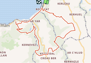
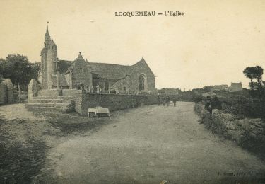
Tocht Stappen van 12,1 km beschikbaar op Bretagne, Côtes-d'Armor, Saint-Michel-en-Grève. Deze tocht wordt voorgesteld door Orcal37.

Beschrijving

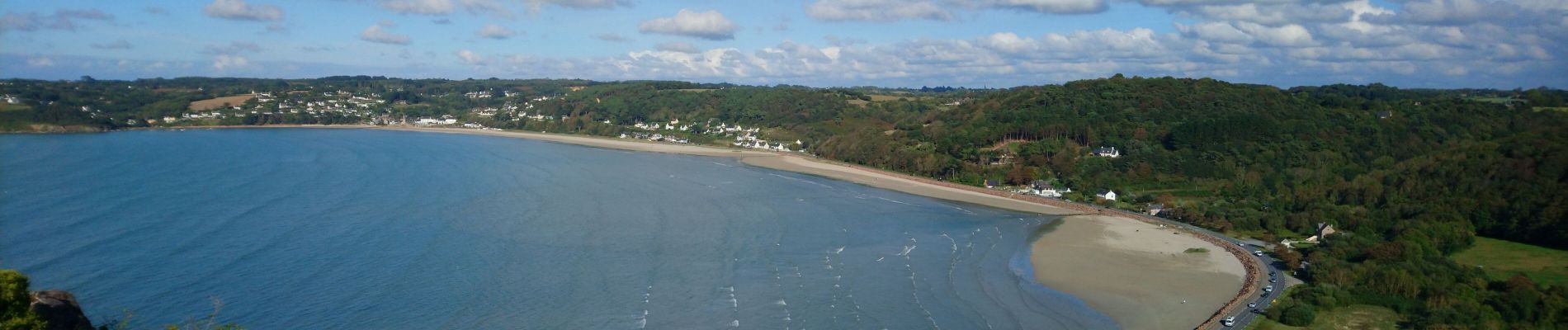
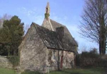
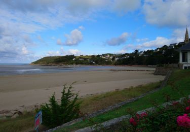
Saint-Michel-en-Grève - Pont ar Roscoat - GR34 - Chapelle Sainte-Geneviève - le Moulin Giglou - le Grand Rocher - 12km 300m 4h05 - 2023 09 13

Hoogteprofiel

Foto's

Plaatsbepaling

Land:
France
Regio :
Bretagne
Departement/Provincie :
Côtes-d'Armor
Gemeente :
Saint-Michel-en-Grève
Locatie:
Unknown
Vertrek:(UTM)
457957 ; 5391713 (30U) N.

Wandeltochten in de omgeving

Tocht Mountainbike Plestin-les-Grèves - Circuit des chapelles, coté terre - Plestin-les-Grèves - Photo
Mountainbike
tracegps

Mountainbike

Medium
(1)
Plestin-les-Grèves, Bretagne, Côtes-d'Armor, France
17,1 km | 20 km-effort
2h 0min
Ja
Tocht Stappen Saint-Michel-en-Grève - Saint-Michel-en-Grève - GR34 Beg ar Forn Église - 7.7km 200m 2h15 (50mn) - 2023 09 13 - Photo
Stappen
Orcal37

Stappen

Medium
Saint-Michel-en-Grève, Bretagne, Côtes-d'Armor, France
7,7 km | 10,4 km-effort
2h 15min
Ja
Tocht Te voet Trédrez-Locquémeau - Circuit des Falaises de Trédrez - Photo
Te voet
PRO

Te voet

Gemakkelijk
Trédrez-Locquémeau, Bretagne, Côtes-d'Armor, France
11,2 km | 14,1 km-effort
3h 11min
Ja
Tocht Stappen Saint-Michel-en-Grève - Bretagne nord J6pm : St Michel en Grève - Locquémau - Photo
Stappen
chessyca

Stappen

Heel gemakkelijk
Saint-Michel-en-Grève, Bretagne, Côtes-d'Armor, France
8,2 km | 10,3 km-effort
2h 19min
Neen
Tocht Stappen Plestin-les-Grèves - Locquirec 07-06-19 - Photo
Stappen
nolsim

Stappen

Medium
Plestin-les-Grèves, Bretagne, Côtes-d'Armor, France
12,4 km | 14,7 km-effort
3h 38min
Neen
Tocht Stappen Plestin-les-Grèves - Plestin les grèves - Photo
Stappen
Marie-Claire-mcp

Stappen

Medium
Plestin-les-Grèves, Bretagne, Côtes-d'Armor, France
11,9 km | 14,7 km-effort
3h 10min
Ja
Tocht Stappen Plestin-les-Grèves - Embouchure du Douron - Plestin Les Grèves - Photo
Stappen
tracegps

Stappen

Medium
Plestin-les-Grèves, Bretagne, Côtes-d'Armor, France
10,7 km | 12,9 km-effort
3h 0min
Ja
Tocht Stappen Plestin-les-Grèves - De Plestin Les Grèves à Saint Efflam - Photo
Stappen
tracegps

Stappen

Medium
(1)
Plestin-les-Grèves, Bretagne, Côtes-d'Armor, France
10,7 km | 13,4 km-effort
4h 0min
Ja
Tocht Stappen Plestin-les-Grèves - Circuit de la chapelle Sainte Anne - Plestin-les-Grèves - Photo
Stappen
tracegps

Stappen

Gemakkelijk
Plestin-les-Grèves, Bretagne, Côtes-d'Armor, France
6,9 km | 8,4 km-effort
1h 40min
Ja


Sluiten
Mijn abonnementen