


A/R Chalet des meules depuis col de Xiard

Emmanuel Remy
Gebruiker
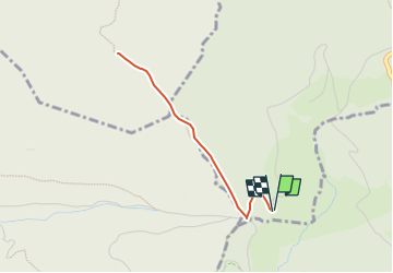

Lengte
3,2 km

Max. hoogte
829 m

Positief hoogteverschil
114 m
Km-Effort
4,7 km

Min. hoogte
727 m

Negatief hoogteverschil
113 m
Boucle
Ja
Datum van aanmaak :
2023-09-23 10:04:04.302
Laatste wijziging :
2025-03-09 16:31:32.156
1h04
Moeilijkheid : Gemakkelijk

Gratisgps-wandelapplicatie
 SityTrail
IGN / Geografische instituten
SityTrail Plus
De wereld gaat voor u open
Over ons
Tocht Stappen van 3,2 km beschikbaar op Grand Est, Vogezen, Vagney. Deze tocht wordt voorgesteld door Emmanuel Remy.
Plaatsbepaling
Land:
France
Regio :
Grand Est
Departement/Provincie :
Vogezen
Gemeente :
Vagney
Locatie:
Unknown
Vertrek:(Dec)
Vertrek:(UTM)
328868 ; 5315083 (32T) N.
Opmerkingen