


Metz Chambière-Paixhans
Le Charme de METZ
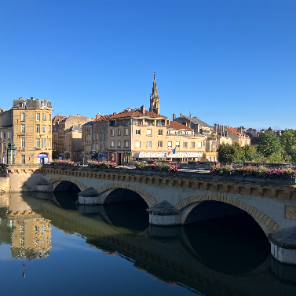
METZ
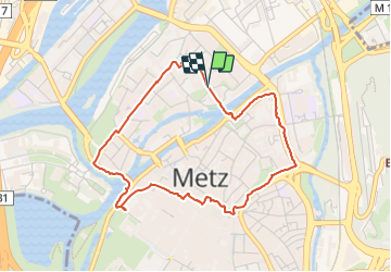

Lengte
4,1 km

Max. hoogte
189 m

Positief hoogteverschil
42 m
Km-Effort
4,7 km

Min. hoogte
165 m

Negatief hoogteverschil
45 m
Boucle
Ja
Datum van aanmaak :
2023-09-24 07:23:59.0
Laatste wijziging :
2023-09-25 20:08:58.038
1h03
Moeilijkheid : Gemakkelijk

Gratisgps-wandelapplicatie
 SityTrail
IGN / Geografische instituten
SityTrail Plus
De wereld gaat voor u open
Over ons
Tocht Stappen van 4,1 km beschikbaar op Grand Est, Moselle, Metz. Deze tocht wordt voorgesteld door Le Charme de METZ.
Foto's

Plaatsbepaling
Land:
France
Regio :
Grand Est
Departement/Provincie :
Moselle
Gemeente :
Metz
Locatie:
Unknown
Vertrek:(Dec)
Vertrek:(UTM)
294043 ; 5445124 (32U) N.
Opmerkingen