


Match

charpe
Gebruiker

Lengte
3,7 km

Max. hoogte
298 m

Positief hoogteverschil
90 m
Km-Effort
4,9 km

Min. hoogte
233 m

Negatief hoogteverschil
93 m
Boucle
Ja
Datum van aanmaak :
2023-09-30 07:44:14.0
Laatste wijziging :
2023-09-30 08:52:14.606
1h07
Moeilijkheid : Gemakkelijk

Gratisgps-wandelapplicatie
 SityTrail
IGN / Geografische instituten
SityTrail Plus
De wereld gaat voor u open
Over ons
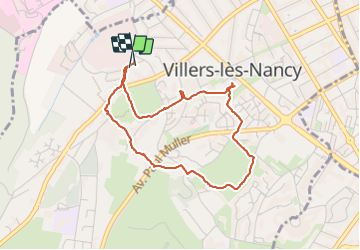
Tocht Stappen van 3,7 km beschikbaar op Grand Est, Meurthe-et-Moselle, Villers-lès-Nancy. Deze tocht wordt voorgesteld door charpe.
Plaatsbepaling
Land:
France
Regio :
Grand Est
Departement/Provincie :
Meurthe-et-Moselle
Gemeente :
Villers-lès-Nancy
Locatie:
Unknown
Vertrek:(Dec)
Vertrek:(UTM)
289812 ; 5395067 (32U) N.
Opmerkingen