


GR34 - 25

loic09
Gebruiker

Lengte
42 km

Max. hoogte
64 m

Positief hoogteverschil
840 m
Km-Effort
54 km

Min. hoogte
-2 m

Negatief hoogteverschil
834 m
Boucle
Neen
Datum van aanmaak :
2015-03-16 00:00:00.0
Laatste wijziging :
2015-03-16 00:00:00.0
6h00
Moeilijkheid : Medium

Gratisgps-wandelapplicatie
 SityTrail
IGN / Geografische instituten
SityTrail Plus
De wereld gaat voor u open
Over ons
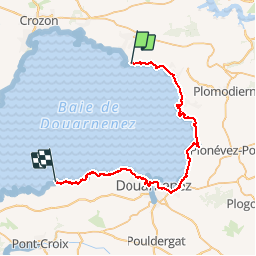
Tocht Lopen van 42 km beschikbaar op Bretagne, Finistère, Telgruc-sur-Mer. Deze tocht wordt voorgesteld door loic09.
Beschrijving
Elléouët/Pointe du Millier
Plaatsbepaling
Land:
France
Regio :
Bretagne
Departement/Provincie :
Finistère
Gemeente :
Telgruc-sur-Mer
Locatie:
Unknown
Vertrek:(Dec)
Vertrek:(UTM)
398877 ; 5340165 (30U) N.
Opmerkingen