


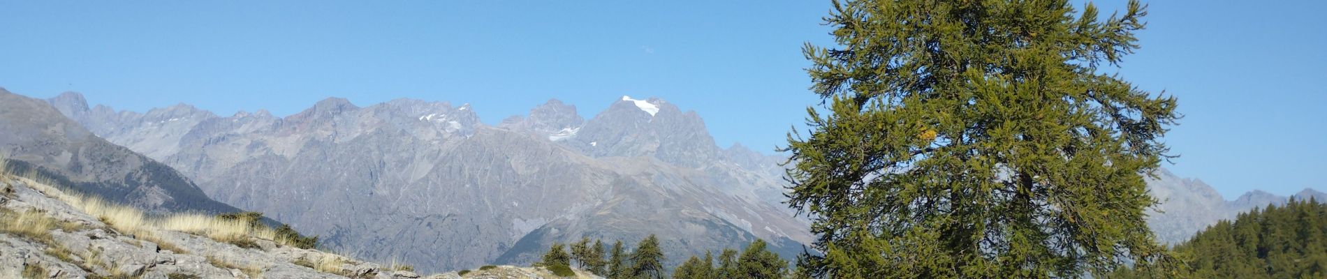
Les Têtes et tête d'Oréac

orsel
Gebruiker GUIDE
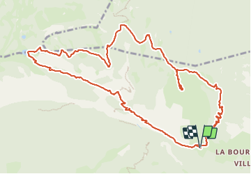

Lengte
14,8 km

Max. hoogte
2074 m

Positief hoogteverschil
1086 m
Km-Effort
29 km

Min. hoogte
1240 m

Negatief hoogteverschil
1093 m
Boucle
Ja
Datum van aanmaak :
2023-10-08 06:56:01.459
Laatste wijziging :
2023-10-08 15:21:10.747
6h23
Moeilijkheid : Medium

Gratisgps-wandelapplicatie
 SityTrail
IGN / Geografische instituten
SityTrail Plus
De wereld gaat voor u open
Over ons
Tocht Stappen van 14,8 km beschikbaar op Provence-Alpes-Côte d'Azur, Hautes-Alpes, L'Argentière-la-Bessée. Deze tocht wordt voorgesteld door orsel.
Foto's


Plaatsbepaling
Land:
France
Regio :
Provence-Alpes-Côte d'Azur
Departement/Provincie :
Hautes-Alpes
Gemeente :
L'Argentière-la-Bessée
Locatie:
Unknown
Vertrek:(Dec)
Vertrek:(UTM)
304888 ; 4962290 (32T) N.
Opmerkingen