


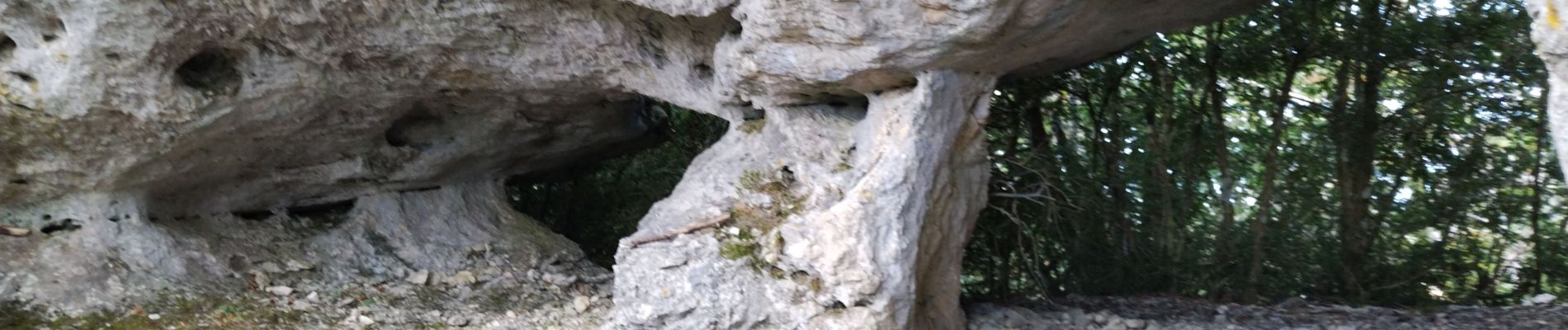
Arches de Combleroufle

cousam
Gebruiker
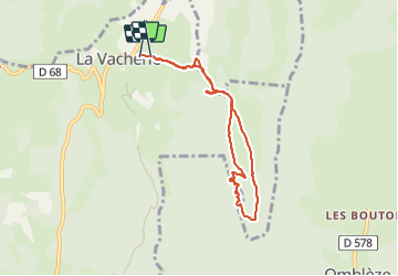

Lengte
7,3 km

Max. hoogte
1222 m

Positief hoogteverschil
356 m
Km-Effort
12 km

Min. hoogte
938 m

Negatief hoogteverschil
344 m
Boucle
Ja
Datum van aanmaak :
2023-10-15 07:28:18.29
Laatste wijziging :
2023-10-15 10:55:36.241
3h26
Moeilijkheid : Medium

Gratisgps-wandelapplicatie
 SityTrail
IGN / Geografische instituten
SityTrail Plus
De wereld gaat voor u open
Over ons
Tocht Stappen van 7,3 km beschikbaar op Auvergne-Rhône-Alpes, Drôme, Le Chaffal. Deze tocht wordt voorgesteld door cousam.
Foto's


Plaatsbepaling
Land:
France
Regio :
Auvergne-Rhône-Alpes
Departement/Provincie :
Drôme
Gemeente :
Le Chaffal
Locatie:
Unknown
Vertrek:(Dec)
Vertrek:(UTM)
672642 ; 4972742 (31T) N.
Opmerkingen