


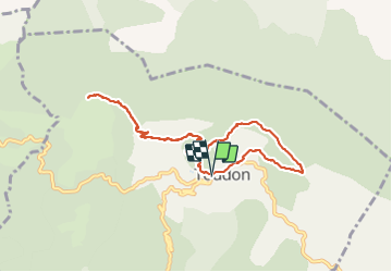
Cime des Colettes par col de Vial

GrouGary
Gebruiker

Lengte
9,5 km

Max. hoogte
1498 m

Positief hoogteverschil
673 m
Km-Effort
18,4 km

Min. hoogte
980 m

Negatief hoogteverschil
675 m
Boucle
Ja
Datum van aanmaak :
2023-10-27 07:28:46.342
Laatste wijziging :
2023-10-28 07:02:58.444
4h11
Moeilijkheid : Medium

Gratisgps-wandelapplicatie
 SityTrail
IGN / Geografische instituten
SityTrail Plus
De wereld gaat voor u open
Over ons
Tocht Stappen van 9,5 km beschikbaar op Provence-Alpes-Côte d'Azur, Alpes-Maritimes, Toudon. Deze tocht wordt voorgesteld door GrouGary.
Beschrijving
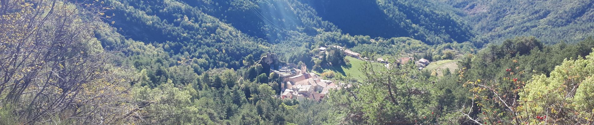
Petite boucle d'automne, sur sentier balisé et sans difficulté technique.
Vue à 360° sur l'Esteron sauvage et tourmenté, le Mercantour
Foto's


Plaatsbepaling
Land:
France
Regio :
Provence-Alpes-Côte d'Azur
Departement/Provincie :
Alpes-Maritimes
Gemeente :
Toudon
Locatie:
Unknown
Vertrek:(Dec)
Vertrek:(UTM)
348397 ; 4862632 (32T) N.
Opmerkingen