


Trace Fede Uhart Mixe Guy

mitch1952
Gebruiker

Lengte
11,1 km

Max. hoogte
294 m

Positief hoogteverschil
336 m
Km-Effort
15,6 km

Min. hoogte
64 m

Negatief hoogteverschil
335 m
Boucle
Ja
Datum van aanmaak :
2023-11-18 08:43:48.0
Laatste wijziging :
2023-11-18 15:48:53.596
5h52
Moeilijkheid : Onbekend

Gratisgps-wandelapplicatie
 SityTrail
IGN / Geografische instituten
SityTrail Plus
De wereld gaat voor u open
Over ons
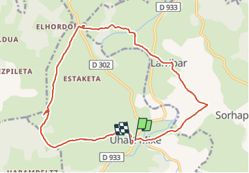
Tocht Stappen van 11,1 km beschikbaar op Nieuw-Aquitanië, Pyrénées-Atlantiques, Uhart-Mixe. Deze tocht wordt voorgesteld door mitch1952.
Plaatsbepaling
Land:
France
Regio :
Nieuw-Aquitanië
Departement/Provincie :
Pyrénées-Atlantiques
Gemeente :
Uhart-Mixe
Locatie:
Unknown
Vertrek:(Dec)
Vertrek:(UTM)
660523 ; 4793668 (30T) N.
Opmerkingen