Tocht Stappen Castans - pic de Nore & Roc du Nouret - Photo

pic de Nore & Roc du Nouret

 chrisgps
chrisgps

Gebruiker

© OpenStreetMap contributors
Lengte
Lengte
19,4 km
Max. hoogte
Max. hoogte
1211 m
Positief hoogteverschil
695 m
Km-Effort
Km-Effort  
29 km
Min. hoogte
Min. hoogte
616 m
Negatief hoogteverschil
698 m
Boucle
Boucle
Ja
Datum van aanmaak :
2023-12-06 08:58:42.846
Laatste wijziging :
2023-12-07 12:00:07.991

(0 Bericht)

Stappen
Stappen
6h31
Moeilijkheid : Medium

Scan deze QR-code om de tocht te openen in de SityTrail-applicatie

Gratisgps-wandelapplicatie

Logo SityTrail SityTrail

IGN / Geografische instituten

SityTrail uit de App Store downloaden SityTrail uit Google Play downloaden

Logo SityTrail SityTrail World

De wereld gaat voor u open

SityTrail uit de App Store downloaden SityTrail uit Google Play downloaden SityTrail op Huawei AppGallery downloaden

Over ons

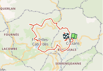
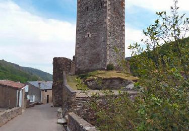
Tocht Stappen van 19,4 km beschikbaar op Occitanië, Aude, Castans. Deze tocht wordt voorgesteld door chrisgps.

Beschrijving

en boucle depuis Laviale-Castant.
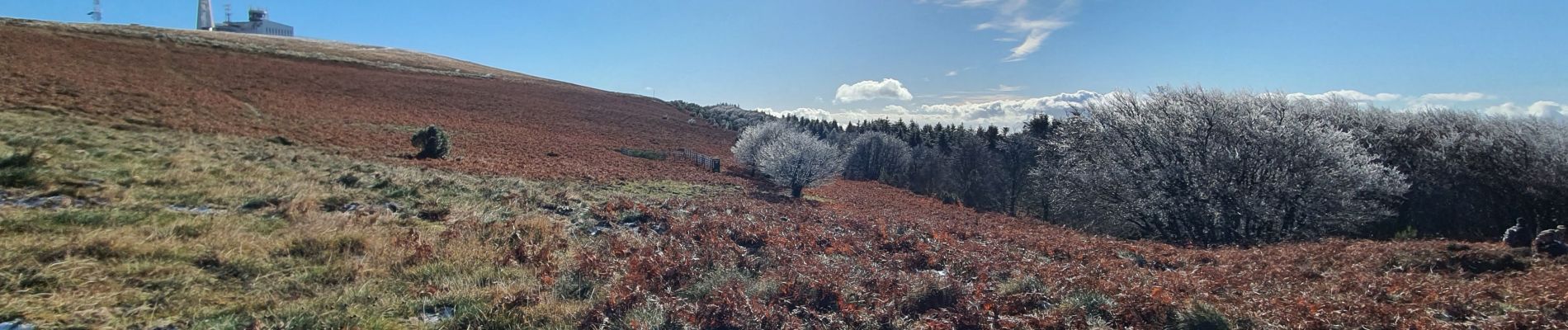
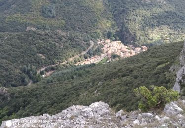
Beaux belvédères

Hoogteprofiel

Foto's

Plaatsbepaling

Land:
France
Regio :
Occitanië
Departement/Provincie :
Aude
Gemeente :
Castans
Locatie:
Unknown
Vertrek:(Dec)
Vertrek:(UTM)
458034 ; 4806143 (31T) N.

Wandeltochten in de omgeving

Tocht Stappen Castans - Boucle des ruisseaux - Castans - Photo
Stappen
tracegps

Stappen

Medium
(5)
Castans, Occitanië, Aude, France
6,4 km | 10 km-effort
4h 0min
Ja
Tocht Te voet Cabrespine - Les Villages Perchés - Photo
Te voet
PRO

Te voet

Gemakkelijk
Cabrespine, Occitanië, Aude, France
8,3 km | 14,7 km-effort
3h 21min
Neen
Tocht Te voet Pradelles-Cabardès - Les Villages Perchés - Photo
Te voet
PRO

Te voet

Medium
Pradelles-Cabardès, Occitanië, Aude, France
19,4 km | 29 km-effort
6h 34min
Neen
Tocht Te voet Pradelles-Cabardès - Les Villages Perchés - Photo
Te voet
PRO

Te voet

Medium
Pradelles-Cabardès, Occitanië, Aude, France
19,2 km | 26 km-effort
5h 53min
Neen
Tocht Te voet Pradelles-Cabardès - Pradelles Cabardes . Le Pic de Nore, le sentier du Roc Nouret. - Photo
Te voet
caccini

Te voet

Gemakkelijk
(1)
Pradelles-Cabardès, Occitanië, Aude, France
10,4 km | 16,4 km-effort
3h 44min
Ja
Tocht Te voet Pradelles-Cabardès - Pradelles,roc de l'aigle,cabrespine,pradelles - Photo
Te voet
Dupleix

Te voet

Moeilijk
Pradelles-Cabardès, Occitanië, Aude, France
15,3 km | 24 km-effort
5h 50min
Ja
Tocht Stappen Citou - Citou et sa château - Photo
Stappen
jsaun

Stappen

Medium
Citou, Occitanië, Aude, France
18,6 km | 26 km-effort
4h 12min
Neen
Tocht Stappen Cabrespine - Cabrespine - Condamine - Photo
Stappen
tracegps

Stappen

Medium
Cabrespine, Occitanië, Aude, France
9,5 km | 14,8 km-effort
3h 0min
Ja
Tocht Stappen Lespinassière - Lespinassière - La Serre d'Alaric - Photo
Stappen
tracegps

Stappen

Medium
Lespinassière, Occitanië, Aude, France
19,1 km | 29 km-effort
6h 30min
Ja


Sluiten
Mijn abonnementen