


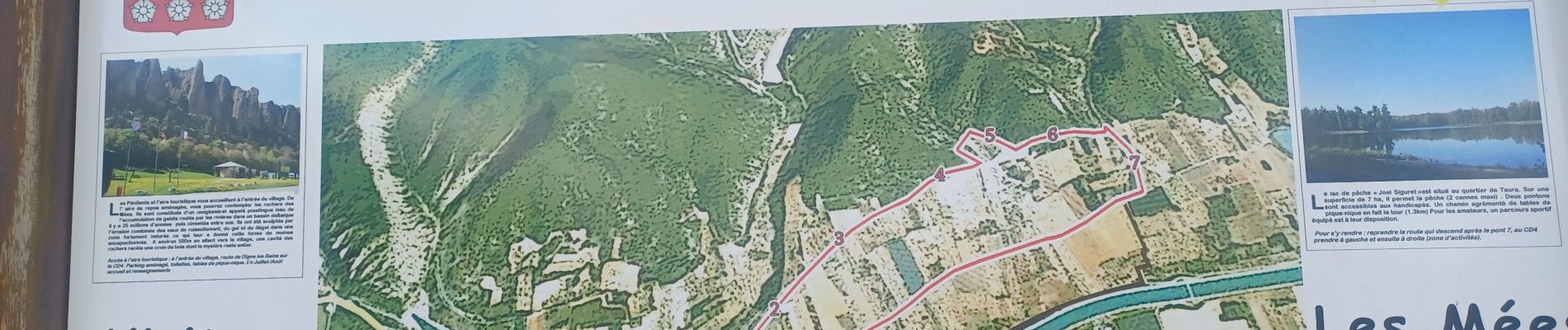
LES MEES . CHEMIN DES OLIVIERS O L

RobinMicheline
Gebruiker GUIDE
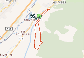

Lengte
6,3 km

Max. hoogte
502 m

Positief hoogteverschil
102 m
Km-Effort
7,7 km

Min. hoogte
419 m

Negatief hoogteverschil
102 m
Boucle
Ja
Datum van aanmaak :
2023-12-13 13:13:42.553
Laatste wijziging :
2023-12-14 06:32:19.269
1h40
Moeilijkheid : Gemakkelijk

Gratisgps-wandelapplicatie
 SityTrail
IGN / Geografische instituten
SityTrail Plus
De wereld gaat voor u open
Over ons
Tocht Stappen van 6,3 km beschikbaar op Provence-Alpes-Côte d'Azur, Alpes-de-Haute-Provence, Les Mées. Deze tocht wordt voorgesteld door RobinMicheline.
Foto's


Plaatsbepaling
Land:
France
Regio :
Provence-Alpes-Côte d'Azur
Departement/Provincie :
Alpes-de-Haute-Provence
Gemeente :
Les Mées
Locatie:
Unknown
Vertrek:(Dec)
Vertrek:(UTM)
737242 ; 4878245 (31T) N.
Opmerkingen