


2023-12-21_07h41m24_D5

LUTZMarc
Gebruiker
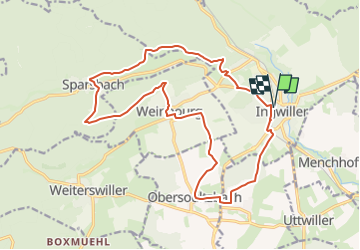

Lengte
18,3 km

Max. hoogte
326 m

Positief hoogteverschil
387 m
Km-Effort
23 km

Min. hoogte
189 m

Negatief hoogteverschil
387 m
Boucle
Ja
Datum van aanmaak :
2023-12-21 06:41:24.44
Laatste wijziging :
2024-11-01 09:01:36.983
5h19
Moeilijkheid : Gemakkelijk

Gratisgps-wandelapplicatie
 SityTrail
IGN / Geografische instituten
SityTrail Plus
De wereld gaat voor u open
Over ons
Tocht Stappen van 18,3 km beschikbaar op Grand Est, Bas-Rhin, Ingwiller. Deze tocht wordt voorgesteld door LUTZMarc.
Beschrijving
Resto au Bois flotté à Weinbourg
Plaatsbepaling
Land:
France
Regio :
Grand Est
Departement/Provincie :
Bas-Rhin
Gemeente :
Ingwiller
Locatie:
Unknown
Vertrek:(Dec)
Vertrek:(UTM)
388338 ; 5414426 (32U) N.
Opmerkingen