


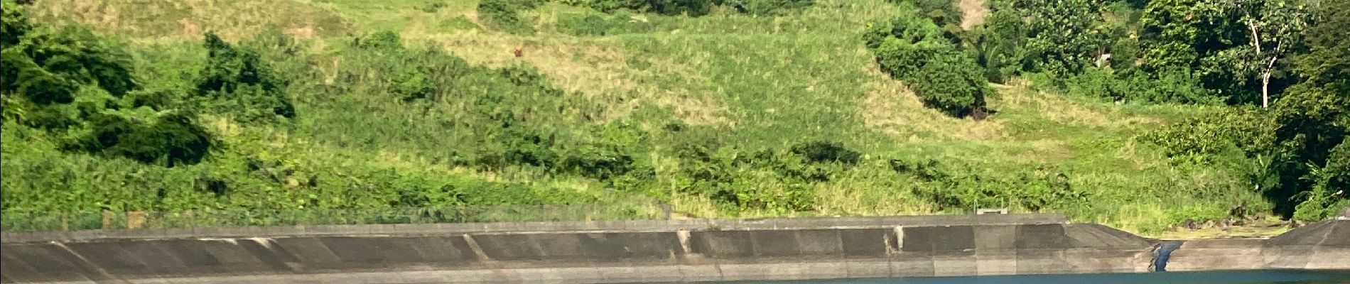
Le Barrage

sameja
Gebruiker
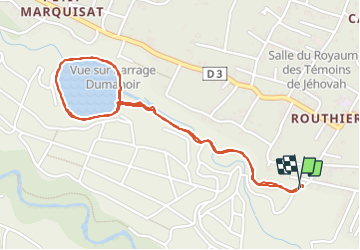

Lengte
4,4 km

Max. hoogte
239 m

Positief hoogteverschil
103 m
Km-Effort
5,8 km

Min. hoogte
171 m

Negatief hoogteverschil
103 m
Boucle
Ja
Datum van aanmaak :
2023-12-22 12:05:34.0
Laatste wijziging :
2023-12-22 13:07:42.378
46m
Moeilijkheid : Medium

Gratisgps-wandelapplicatie
 SityTrail
IGN / Geografische instituten
SityTrail Plus
De wereld gaat voor u open
Over ons
Tocht Trail van 4,4 km beschikbaar op Guadeloupe, Onbekend, Capesterre-Belle-Eau. Deze tocht wordt voorgesteld door sameja.
Beschrijving
Capesterre-Belle-Eau
Foto's


Plaatsbepaling
Land:
France
Regio :
Guadeloupe
Departement/Provincie :
Onbekend
Gemeente :
Capesterre-Belle-Eau
Locatie:
Unknown
Vertrek:(Dec)
Vertrek:(UTM)
650034 ; 1773540 (20Q) N.
Opmerkingen