


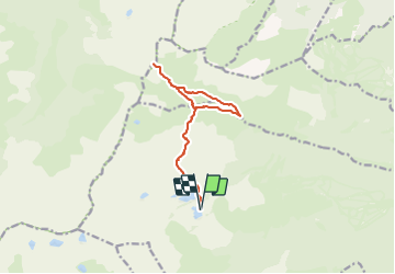
Portella d'Orlu et vallée de Galba depuis refuge Camporells

34christophe
Gebruiker

Lengte
12,9 km

Max. hoogte
2330 m

Positief hoogteverschil
875 m
Km-Effort
25 km

Min. hoogte
1800 m

Negatief hoogteverschil
875 m
Boucle
Ja
Datum van aanmaak :
2024-01-03 20:27:18.435
Laatste wijziging :
2024-01-03 20:30:38.803
5h34
Moeilijkheid : Zeer moeilijk

Gratisgps-wandelapplicatie
 SityTrail
IGN / Geografische instituten
SityTrail Plus
De wereld gaat voor u open
Over ons
Tocht Stappen van 12,9 km beschikbaar op Occitanië, Pyrénées-Orientales, Formiguères. Deze tocht wordt voorgesteld door 34christophe.
Beschrijving
refuge, Portella d'Orlu, vallée de Galbe, refuge
Plaatsbepaling
Land:
France
Regio :
Occitanië
Departement/Provincie :
Pyrénées-Orientales
Gemeente :
Formiguères
Locatie:
Unknown
Vertrek:(Dec)
Vertrek:(UTM)
418899 ; 4719323 (31T) N.
Opmerkingen