


Le télégraphe de Chappe-12-01-2024

Christiancordin
Gebruiker

Lengte
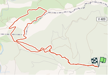
8 km

Max. hoogte
422 m

Positief hoogteverschil
317 m
Km-Effort
12,2 km

Min. hoogte
114 m

Negatief hoogteverschil
315 m
Boucle
Ja
Datum van aanmaak :
2024-01-12 13:04:18.718
Laatste wijziging :
2024-01-20 18:09:42.888
2h22
Moeilijkheid : Medium

Gratisgps-wandelapplicatie
 SityTrail
IGN / Geografische instituten
SityTrail Plus
De wereld gaat voor u open
Over ons
Tocht Stappen van 8 km beschikbaar op Provence-Alpes-Côte d'Azur, Var, Ollioules. Deze tocht wordt voorgesteld door Christiancordin.
Beschrijving
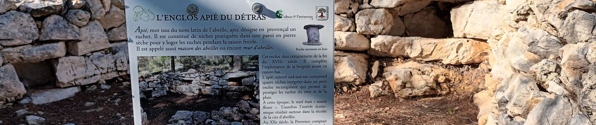
PK de Châteauvallon, le Détras, l'apié, col du Télégraphe, GR51, Capeu Gros, limite de commune, télégraphe de Chappe.
Foto's


Plaatsbepaling
Land:
France
Regio :
Provence-Alpes-Côte d'Azur
Departement/Provincie :
Var
Gemeente :
Ollioules
Locatie:
Unknown
Vertrek:(Dec)
Vertrek:(UTM)
733919 ; 4781143 (31T) N.
Opmerkingen