


PR_56_Camors_CA_03_Tro-Bourk_Circuit1b_20240126

patrickdanilo
Gebruiker
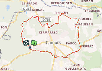

Lengte
11 km

Max. hoogte
128 m

Positief hoogteverschil
207 m
Km-Effort
13,8 km

Min. hoogte
42 m

Negatief hoogteverschil
211 m
Boucle
Ja
Datum van aanmaak :
2024-01-26 08:13:37.786
Laatste wijziging :
2025-07-28 11:23:14.768
3h08
Moeilijkheid : Gemakkelijk

Gratisgps-wandelapplicatie
 SityTrail
IGN / Geografische instituten
SityTrail Plus
De wereld gaat voor u open
Over ons
Tocht Stappen van 11 km beschikbaar op Bretagne, Morbihan, Camors. Deze tocht wordt voorgesteld door patrickdanilo.
Beschrijving
Randonnée Marche de 11 km à découvrir à Bretagne, Morbihan, Camors. Cette randonnée est proposée par patrickdanilo.
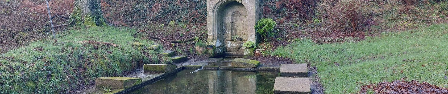
Foto's


Plaatsbepaling
Land:
France
Regio :
Bretagne
Departement/Provincie :
Morbihan
Gemeente :
Camors
Locatie:
Unknown
Vertrek:(Dec)
Vertrek:(UTM)
498942 ; 5299039 (30T) N.
Opmerkingen