


Groeneveld nat

tuinvrouwtje
Gebruiker
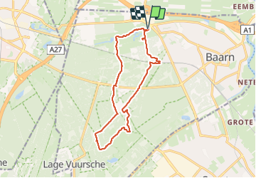

Lengte
13,1 km

Max. hoogte
33 m

Positief hoogteverschil
121 m
Km-Effort
14,7 km

Min. hoogte
1 m

Negatief hoogteverschil
122 m
Boucle
Ja
Datum van aanmaak :
2024-01-26 08:18:21.0
Laatste wijziging :
2024-01-26 11:35:45.914

Gratisgps-wandelapplicatie
 SityTrail
IGN / Geografische instituten
SityTrail Plus
De wereld gaat voor u open
Over ons
Tocht van 13,1 km beschikbaar op Utrecht, Onbekend, Baarn. Deze tocht wordt voorgesteld door tuinvrouwtje.
Beschrijving
Gjhfg
Plaatsbepaling
Land:
Netherlands
Regio :
Utrecht
Departement/Provincie :
Onbekend
Gemeente :
Baarn
Locatie:
Unknown
Vertrek:(Dec)
Vertrek:(UTM)
654255 ; 5787866 (31U) N.
Opmerkingen