


castirando 2024

mthomas30
Gebruiker

Lengte
9,7 km

Max. hoogte
102 m

Positief hoogteverschil
192 m
Km-Effort
12,3 km

Min. hoogte
42 m

Negatief hoogteverschil
192 m
Boucle
Ja
Datum van aanmaak :
2024-03-02 14:56:37.537
Laatste wijziging :
2024-03-02 17:21:06.687
2h07
Moeilijkheid : Medium

Gratisgps-wandelapplicatie
 SityTrail
IGN / Geografische instituten
SityTrail Plus
De wereld gaat voor u open
Over ons
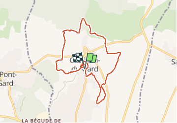
Tocht Stappen van 9,7 km beschikbaar op Occitanië, Gard, Castillon-du-Gard. Deze tocht wordt voorgesteld door mthomas30.
Plaatsbepaling
Land:
France
Regio :
Occitanië
Departement/Provincie :
Gard
Gemeente :
Castillon-du-Gard
Locatie:
Unknown
Vertrek:(Dec)
Vertrek:(UTM)
624696 ; 4869644 (31T) N.
Opmerkingen