


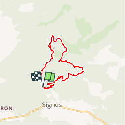
Signes - Le Mourré d'Agnis

frizou83
Gebruiker

Lengte
12,7 km

Max. hoogte
911 m

Positief hoogteverschil
569 m
Km-Effort
20 km

Min. hoogte
420 m

Negatief hoogteverschil
567 m
Boucle
Ja
Datum van aanmaak :
2015-03-25 00:00:00.0
Laatste wijziging :
2015-03-25 00:00:00.0
4h23
Moeilijkheid : Gemakkelijk

Gratisgps-wandelapplicatie
 SityTrail
IGN / Geografische instituten
SityTrail Plus
De wereld gaat voor u open
Over ons
Tocht Stappen van 12,7 km beschikbaar op Provence-Alpes-Côte d'Azur, Var, Signes. Deze tocht wordt voorgesteld door frizou83.

Plaatsbepaling
Land:
France
Regio :
Provence-Alpes-Côte d'Azur
Departement/Provincie :
Var
Gemeente :
Signes
Locatie:
Unknown
Vertrek:(Dec)
Vertrek:(UTM)
731799 ; 4798068 (31T) N.
Opmerkingen